
 English
 Español
 Français
 Italiano
 Deutsch
 Русский
 Português
 Polski
 Română
 Svenska
 Norsk bokmål
 Suomi
 Türkçe
 العربية
 简体中文
 한국어
 हिन्दी
 Ελληνικά
DOOR 02 · ASIA · INFLUENCE
Hittites
The tablet crosses Anatolia
Continued at the Hittite Museum
Museum documentation · free public access, no account required.
Generated reconstruction · Declared visual hypothesis
Declared visual reconstruction; not a photograph of the original nor documentary evidence.
Why this doorway leads to another museum
Hattusa's scribes worked with cuneiform and Akkadian within a literate tradition born and transformed over centuries in Mesopotamia.
Why this gate requires caution: It was not a direct borrowing from contemporary Sumerian cities: it mediated a long Akkadian, Babylonian and Assyrian tradition.
Period of the connection: II millennium BCE
BEFORE YOU ENTER
An introduction to Hittites
Find your place in time, explore the changes and choose where to go next.
- When
- ≈1650 BCE · WESTERN ASIA
- Where
- Hattusa and the central Anatolian plateau.
- What this collection brings together
- Imperial kingdom · multilingual society
The Hittite kingdom connected and disputed the spaces of Egypt, Mesopotamia, and Syria. It was a multilingual power sustained by archives and alliances, not a homogeneous cultural block.
From Hattusa, a monarchy capable of integrating diverse territories entered the international diplomatic system of the Late Bronze Age.
PLACE MATTERS
Territory and connections
Hattusa and the central Anatolian plateau. Anatolia, northern Syria, and the Levant; one of the great powers of the Late Bronze Age.
A HISTORY OF CHANGE
The main periods
Dates are approximate. Periods help us navigate the past, but their boundaries were not always the same in every region.
c. 2000–1700 BCE
Kaneš and Anatolian principalities
Cities and merchant colonies connect a multilingual Anatolia; a territorial Hittite state does not yet exist.
c. 1650–1500 BCE
Old Kingdom of Hatti
Hattusa consolidated its position, and its kings projected power across Anatolia and into northern Syria with mixed results.
c. 1500–1430 BCE
Middle Kingdom and recomposition
External pressures and dynastic changes reduced or contested the sphere of influence of Hattusa; the chronological division is a modern construct.
c. 1430–1320 BCE
Imperial expansion
The kings of Hatti incorporated much of Anatolia and Syrian states; vassalage and direct administration must be distinguished.
Continue the story: 3 more periods
c. 1320–1200 BCE
Kadesh, treaty and maturity
Hatti retained northern Syria and made a pact with Egypt; the Battle of Kadesh did not produce the total victory proclaimed by Ramesses II.
c. 1200–1180 BCE
End of the empire
Hattusa ceased to function as an imperial capital and the territorial system broke down; not all Anatolian populations or languages disappeared.
c. 1180–700 BCE
Syro-Anatolian states
Carchemish and other kingdoms transformed Luwian and Hittite traditions until their incorporation by powers such as Assyria.
BEYOND THE DATES
How people lived and saw the world
How they were organised
The kings of Hatti governed a constellation of territories through campaigns, oaths, marriages and treaties of fidelity. The archive shows reciprocal obligations and negotiated successions, not a uniform administration applied from Hattusa.
Puduhepa acted as a great queen in diplomacy and cult, while agreements such as that of Alaksandu integrated regional rulers. Hittite authority depended as much on chancelleries and witness gods as on military force.
What daily life was like
Letters, recipes, laws and rituals preserve the activities of scribes, messengers, healers and officiants. Their survival makes institutional specialists visible, but leaves much less direct voice from rural households and unlettered workers.
The capital depended on transporting water, food, wood and clay across difficult terrain. The maintenance tasks that supported walls, storehouses and festivals rarely bear the names of those who performed them.
What they knew how to do
The fortifications combined stone foundations with large volumes of mudbrick and timber frameworks. The unequal durability of these materials explains why the modern visitor perceives more stone and less built architecture.
Cuneiform adapted clay and reed stylus to several languages, while the metalwork of the stag vessel assembled numerous hammered sheets. Both technologies required chains of learning and repair invisible in the finished piece.
What they believed
Yazılıkaya arranges divine processions in rock chambers and combines names, headdresses and attendant animals from Hittite and Hurrian traditions. The sanctuary turns landscape, image and dynasty into a single ritual experience.
Inventories, prayers and foreign recitations show a cult capable of incorporating regional gods and languages. The prayers of Muršili interpret the epidemic through guilt, oath and consultation of the archive.
Who they interacted with
Hatti connected Anatolia, Syria and Egypt through gifts, messengers, metals, textiles and pacts. Diplomatic circulation was not modern free trade: prestige, tribute and alliance could move the same goods.
Carchemish controlled a strategic crossing of the Euphrates and survived as a regional centre after 1200 BCE. This continuity favoured exchanges, although it does not prove that all previous routes remained intact.
Art, music and storytelling
The lions of the gate, the processions of Yazılıkaya and the frieze of the stag vessel transform transit, rock and metal into images of authority. Each medium conditions scale, light and mode of approach.
On the vessel, a deity on a stag, a libation and possible musicians or bearers form a ritual sequence. The identities of all the figures and of the object are less certain than their technique and iconography.
PEOPLE AND TESTIMONIES
Meet the people
The records distinguish historical figures, representations and reconstructions. They explain their context, the available sources and their connections with other people.
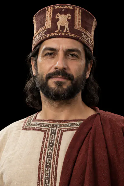
The Prayers of Mursili
In the face of a long epidemic, Mursili II consulted archives and oracles seeking a religious explanation.
Read the record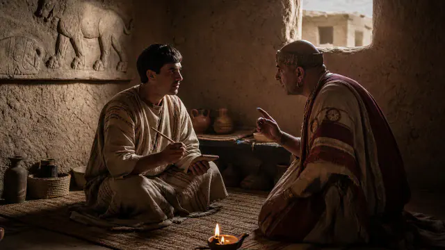
The Voice of Kalašma
A tablet written in Hittite includes a ritual in another language, now called Kalasmaic.
Read the record
Puduhepa
Puduhepa directed palace and cult affairs and maintained correspondence with the Egyptian court.
Read the recordLOOK CLOSER
Objects and places to start with
A selection from the destination museum. Open each record to explore its documentation and images.
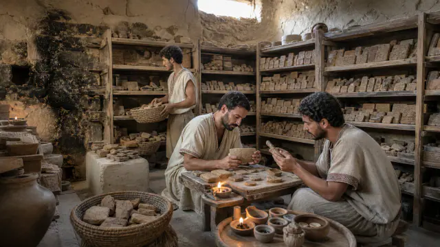
Boğazköy Archive
Treaties, ritual recipes and letters survived because the fire baked part of the clay.
Read the record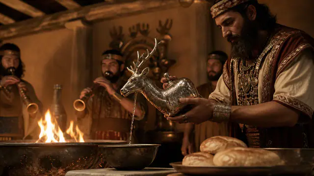
Stag Vessel
This silver vessel in the shape of a stag is decorated with a scene of offering to the gods.
Read the record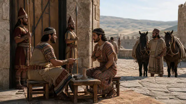
Alaksandu of Wilusa
The treaty with Alaksandu of Wilusa fixed obligations of protection and loyalty towards the Hittite king.
Read the record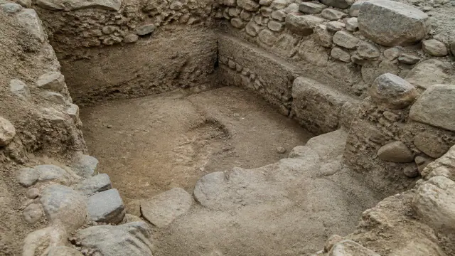
Osmankayası and Ilıca
The known cemeteries include cremations and inhumations, but we do not have an identified Hittite royal tomb.
Read the recordWHAT REMAINS
Its legacy and ongoing research
After the imperial collapse, Luwian traditions and Neo-Hittite Syrian kingdoms continued regionally; their archives reveal one of the earliest documented international systems.
CHOOSE YOUR NEXT STOP
Inside this museum
Sources for this introduction
Each theme links to its documentation. The full bibliography also brings together sources for the chronology, the people and the connection between the museums.
View all sources and references →Evidence and interpretation
Level of evidence of connection: high. The door describes influence; it does not convert two different cultures into one nor does it presuppose automatic ethnic continuity.
Catalogue facts
- Contact period
- II millennium BCE
- Destination museum
- Hittite
- Link Type
- influence
- Level of evidence
- high
- Destination region
- Western Asia
A closer look
About 1 min to read · 1 section. Further reading and sources · free access. Editorial review recorded: .
Preserve other languages within a ritual
The Hattusa archives include passages in languages other than Hittite. A text excavated at 2023 incorporates a recitation identified with Kalasma within Hittite ritual instructions; Other tablets preserve Luwite, Palaite and Hatic. This example allows us to specify the fate of inherited cuneiform technology: scribes used it to record diverse linguistic traditions. The Mesopotamian connection is better understood by following practices of formation and copying than by imagining a single transfer between two peoples or an equivalence between language and writing.
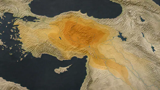
Location and territory
REGIONAL AREA
Central Anatolia and, in imperial phases, northern SyriaCentral Anatolia and, in imperial phases, northern Syria. The footprint marks the indicative center of the area, not a border or an exact point.Cultural connections
Sources and references
- The Metropolitan Museum of Art · The Origins of Writing
- Deutsches Archäologisches Institut · New language in a Hattusa tablet
- The Metropolitan Museum of Art · Guide to Ancient Near Eastern Art
- German Archaeological Institute · Discovery of the Kalasma language
- UNESCO · Hattusha
- UNESCO Memory of the World · Boğazköy tablets
- Hethitologie-Portal Mainz · Catalogue des Textes Hittites
- The Metropolitan Museum of Art · The Hittites
- The Metropolitan Museum of Art · Vessel terminating in the forepart of a stag
- Metropolitan Museum Journal · The Silver Stag Vessel: A Royal Gift
- UNESCO World Heritage Centre · Hattusha: the Hittite Capital
- Hethitology Portal Mainz–Würzburg · Plague prayers and divination
- The Metropolitan Museum of Art · Cultures in Contact
- The Metropolitan Museum of Art · Šuppiluliuma, war and plague
- The Met · Anatolian vessel
- The Met · Laramas relief
- Universität Würzburg · New Indo-European Language Discovered
- Institute for the Study of Ancient Cultures · Women in Hittite ritual and power
- The Metropolitan Museum of Art · Hittite royal cult inventories
YOUR NEXT VISIT
Explore Hittites
The same collection, two ways to explore. Choose the experience that suits you.
Did you enjoy this exhibit?
Your opinion helps us improve the museum. You can change it whenever you like.
Loading your rating…