
 English
 Español
 Français
 Italiano
 Deutsch
 Русский
 Português
 Polski
 Română
 Svenska
 Norsk bokmål
 Suomi
 Türkçe
 العربية
 简体中文
 한국어
 हिन्दी
 Ελληνικά
EAST ASIA · ARCHAEOLOGICAL CULTURE · REGIONAL SOCIETIES
Yayoi
Yayoi and ancient Japan
Rice, metal and continental contacts reorganised an archipelago.
Museum documentation · free public access, no account required.
Generated reconstruction · Declared visual hypothesis
Declared visual reconstruction; not a photograph of the original nor documentary evidence.
Why this doorway leads to another museum
Yayoi introduced or expanded wet rice agriculture, metallurgy and new hierarchies through contacts with the Korean peninsula and the continent. It does not yet equal the Yamato state.
Wet rice, metal and new population movements reorganised settlements, labour and social inequality across much of the archipelago. Technologies, crops and people circulated from the Korean peninsula and China. Yayoi expansion coexisted with Jōmon continuities and regional differences.
Period covered by the destination museum: c. 300 BCE · working chronology
BEFORE YOU ENTER
An introduction to Yayoi
Find your place in time, explore the changes and choose where to go next.
- When
- c. 300 BCE · working chronology · EAST ASIA
- Where
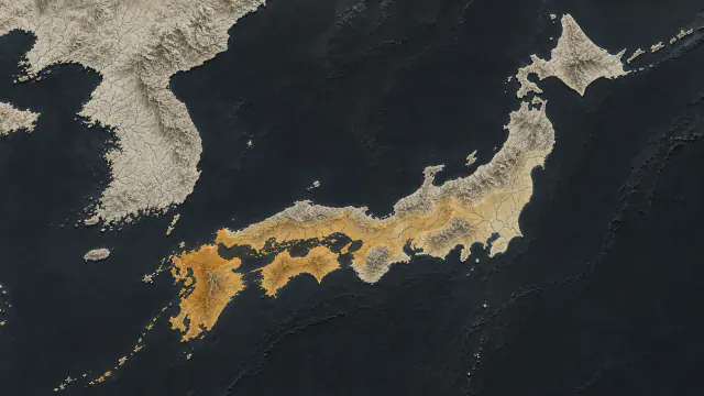
- Northern Kyūshū and western Japan.
- What this collection brings together
- Archaeological culture · regional societies
Yayoi introduced or expanded wet rice agriculture, metallurgy and new hierarchies through contacts with the Korean peninsula and the continent. It does not yet equal the Yamato state.
Wet rice, metal and new population movements reorganised settlements, labour and social inequality across much of the archipelago.
PLACE MATTERS
Territory and connections
Northern Kyūshū and western Japan. From Kyūshū towards eastern and northern Honshū with uneven regional rhythms.
A HISTORY OF CHANGE
The main periods
Dates are approximate. Periods help us navigate the past, but their boundaries were not always the same in every region.
before c. 900 BCE
Final Jōmon and continental contacts
Crops, objects and people circulate towards the archipelago before Yayoi; contact does not mean instantaneous demographic substitution.
c. X–VIII centuries BCE
Initial wet rice
Fields and new ceramics appear in northern Kyūshū; absolute dates and phase name continue to be revised.
c. VIII–III centuries BCE
Regional expansion
Rice paddies and Yayoi assemblages advance eastward with persisting Jōmon and uneven local rhythms.
c. III centuries BCE–I century CE
Metal, moats and new hierarchies
Bronze, iron and fortified villages extend westward and centreward; regional differences remain large.
Continue the story: 3 more periods
1st–3rd centuries CE
Polities of Wa
Han and Wei sources describe numerous countries of Wa; the archipelago does not yet constitute a unitary state.
c. 180–250 CE
Himiko and Yamatai
A coalition recognises Himiko, but the location of Yamatai remains debated; an alternative halo is shown, not a secure boundary.
from mid-third century CE
Kofun transition
Large tumuli and new elites concentrate power in Kinai; Kofun/Yamato is a new phase, not simply 'imperial Yayoi'.
BEYOND THE DATES
How people lived and saw the world
How they were organised
Yoshinogari separated residential, ceremonial, productive and funerary enclosures by moats and palisades. This zoning reveals authority, but calling the settlement a 'kingdom' is an interpretation of the park, not a title found in an inscription.
The Wei zhi describes numerous countries of Wa and Himiko as a ruler chosen after disturbances. The text attests to diplomacy and hierarchy in the third century, although it does not unequivocally locate Yamatai.
What daily life was like
Most agricultural tools were of wood: hoes, spades and rakes were made with stone or iron blades. Toro preserves this perishable infrastructure that usually disappears from other sites.
Linen and silk textiles, cooking and storage ceramics, wells and large homes extend life beyond warriors and priests. Regional differences prevent designing a single 'Yayoi' costume valid for a thousand years.
What they knew how to do
The rice paddy is a landscape technology: it combines hydraulic engineering, seeds, calendar and cooperation. Its transfer from the peninsula required adapting varieties and practices to local soils and climates.
Bronze and iron followed different trajectories. Bronze became monumental and ritual in dōtaku, while scarce iron improved edges; stone and wood continued to work alongside both.
What they believed
Dōtaku with thin walls evolved from sound bells into objects of visual display. Burying thirty-nine together at Kamo Iwakura was a deliberate action, although it is unknown whether it closed, protected or transferred authority.
Himiko is described by a Chinese expression related to spiritual practices. Translating it simply as 'shaman' can obscure the Wei perspective and the combination of ritual, diplomacy and government.
Who they interacted with
Rice, metal, mirrors, beads and people circulated through the Korea Strait and the Inland Sea. Shared moulds of dōtaku and imported pottery connect communities without the need for a central power directing all exchange.
The embassy of 238–239 turned objects into diplomacy: Wei conferred titles, textiles and mirrors on Himiko. The written list documents the narrated gift, but does not allow us to recognise today which specific specimens arrived.
Art, music and storytelling
Red pottery, mirrors, dōtaku and painted vessels built regional repertoires. At Karako-Kagi, fragments with drawn buildings inform how a community imagined its architecture.
Early dōtaku could sound via clapper, but many later ones grew and thinned until privileging visibility. Calling them bells does not guarantee that the thirty-nine at Kamo Iwakura were sounded.
PEOPLE AND TESTIMONIES
Meet the people
The records distinguish historical figures, representations and reconstructions. They explain their context, the available sources and their connections with other people.
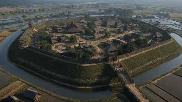
The V-shaped ditch
Deep ditches, palisades and towers show a community that expected threats and controlled access.
Read the record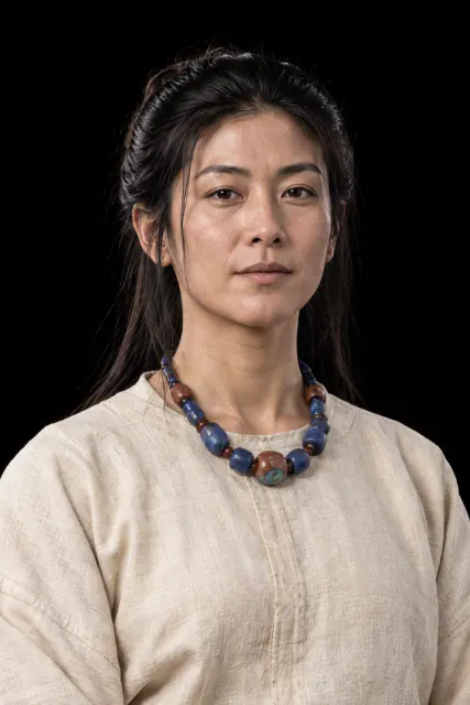
Forty broken mirrors
Five mirrors of 46.5 centimetres, the largest of their type in Japan, were broken before or during burial.
Read the record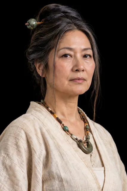
The queen known from China
A Chinese chronicle describes a ruling woman who stabilised Wa and sent an embassy to the Wei emperor.
Read the recordLOOK CLOSER
Objects and places to start with
A selection from the destination museum. Open each record to explore its documentation and images.
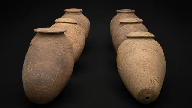
Two rows of coffins
Thousands of large jars formed an ordered cemetery where children and adults received different treatments.
Read the record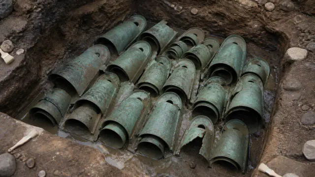
Thirty-nine buried bells
The largest known set of Yayoi bells was placed on its side on a slope and never recovered.
Read the record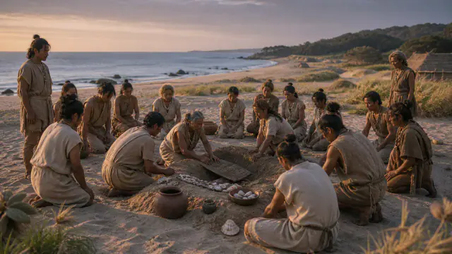
Three hundred lives in the sand
The remains of about three hundred people allow investigation of their diet, kinship and movements.
Read the record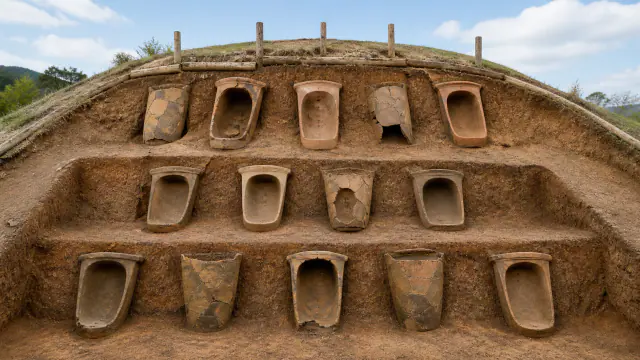
Northern mound
Several people were buried in large jars with swords, glass beads and other valuable objects.
Read the recordWHAT REMAINS
Its legacy and ongoing research
Yayoi societies are important antecedents of later formations, including Yamato, without yet being a state or a finished Japanese national identity.
CHOOSE YOUR NEXT STOP
Inside this museum
Sources for this introduction
Each theme links to its documentation. The full bibliography also brings together sources for the chronology, the people and the connection between the museums.
View all sources and references →Evidence and interpretation
This window distinguishes the documented core of its historical reach: northern Kyūshū and western Japan. The label 'Yayoi' summarises a changing trajectory, not an immobile population nor a universal stage of progress.
Catalogue facts
- Narrative date
- c. 300 BCE · working chronology
- Location
- Northern Kyūshū and western Japan.
- Type of entity
- Archaeological culture · regional societies
- Scope
- From Kyūshū towards eastern and northern Honshū with uneven regional rhythms.
- Key innovation
- Inundated rice paddies and communal water management
- Legacy
- Yayoi societies are important antecedents of later formations, including Yamato, without yet being a state or a finished Japanese national identity.
A closer look
About 1 min to read · 1 section. Further reading and sources · free access. Editorial review recorded: .
Storing rice was not a one-off operation
The Yoshinogari guide distinguishes between rice stored in spikes and unhusked grain. Both are documented in the Yayoi period; for interpreting the stores, the park also uses comparisons with practices from the later Nara period, when storage forms had different uses. It is important to keep this temporal distance visible. The elevated buildings and rice remains allow questions about reserves, consumption and food protection, but a later analogy alone does not prove the existence of the same fiscal system nor the exact function of each construction.
- Heritage · Yoshinogari Historical Park · Grain Storehouses, guide 57Access recorded: .
Location and territory
REGIONAL AREA
Northern Kyūshū and western Japan.From Kyūshū towards western and eastern Japan with uneven rhythms. The footprint indicates the orientative centre of the area, not a boundary nor an exact point.Cultural connections
Sources and references
- Yoshinogari Historical Park · Moat-Encircled Village Zone
- Fukuoka City · Itazuke archaeological site
- Shimane Museum of Ancient Izumo · Bronze bells from Kamo-Iwakura
- Yoshinogari Historical Park · Grain Storehouses, guide 57
- Yoshinogari Historical Park
- Yoshinogari Historical Park · The History of Yoshinogari
- National Diet Library · Treatise on the people of Wa in the chronicle of Wei
- National Museum of Japanese History · What is Yayoi Culture?
- University Museum, University of Tokyo · Yayoi pottery of the Kanto Region
- Shizuoka City · Prehistory and the Toro Site
- National Museum of Japanese History · When did the Yayoi period begin?
- National Museum of Japanese History · Bronze and iron production in Yayoi Kinki
- Shimane Official Travel Guide · Kamo Iwakura Ruins
- Kyushu National Museum · Hirabaru objects
- Tawaramoto Town · Karako-Kagi Site
- Itoshima City · Hirabaru Site
- Yoshinogari · Governing class garments
- Yoshinogari · Yayoi Trivia
- National Diet Library — Japan in five ancient Chinese chronicles
- Kyushu National Museum · Himiko and the mirrors
YOUR NEXT VISIT
Explore Yayoi
The same collection, two ways to explore. Choose the experience that suits you.
Did you enjoy this exhibit?
Your opinion helps us improve the museum. You can change it whenever you like.
Loading your rating…