
 English
 Español
 Français
 Italiano
 Deutsch
 Русский
 Português
 Polski
 Română
 Svenska
 Norsk bokmål
 Suomi
 Türkçe
 العربية
 简体中文
 한국어
 हिन्दी
 Ελληνικά
EAST ASIA · REGIONAL STATE FORMATION
Gojoseon
Gojoseon and ancient Korea
To understand Gojoseon, one must distinguish foundation traditions from the remains and documents that can be dated.
Museum documentation · free public access, no account required.
Generated reconstruction · Declared visual hypothesis
Declared visual reconstruction; not a photograph of the original nor documentary evidence.
Why this doorway leads to another museum
Traditions place Gojoseon in a much more remote past, but historical certainty increases in the late first millennium BCE. Foundational memory and evidence must be shown separately.
Regional hierarchies supported by agriculture, metal and border networks began to be recognisable as a state formation in historical sources. Exchanges and conflicts connected Liaoning, the Korean peninsula and northern Chinese states. Gojoseon was not an anticipated modern nation.
Period covered by the destination museum: ≈4th–3rd centuries BCE · secure historical evidence
BEFORE YOU ENTER
An introduction to Gojoseon
Find your place in time, explore the changes and choose where to go next.
- When
- ≈4th–3rd centuries BCE · secure historical evidence · EAST ASIA
- Where
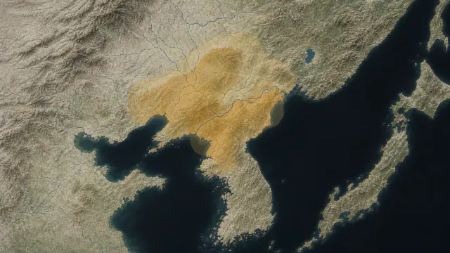
- Liaoning, southern Manchuria and the northern Korean peninsula.
- What this collection brings together
- Regional state formation
Traditions place Gojoseon in a much more remote past, but historical certainty increases in the late first millennium BCE. Foundational memory and evidence must be shown separately.
Regional hierarchies supported by agriculture, metal and border networks began to be recognisable as a state formation in historical sources.
PLACE MATTERS
Territory and connections
Liaoning, southern Manchuria and the northern Korean peninsula. Northwestern Korean areas and Manchuria; historical precedent for later Korean states.
A HISTORY OF CHANGE
The main periods
Dates are approximate. Periods help us navigate the past, but their boundaries were not always the same in every region.
c. 1500–500 BCE
Mumun and Liaoning bronzes
Agriculture, dolmens and bronze daggers articulate regional hierarchies; their distribution is not a boundary of Gojoseon.
4th–3rd centuries BCE
Historically visible Joseon
Sources from the Warring States name Joseon; its centre and exact extent between Liaoning and northern Korea remain debated.
c. 300 BCE
Yan pressure
Yan's advance reduces or displaces Joseon's sphere; the precise magnitude and location depend on later sources.
c. 194–109 BCE
Wiman Joseon
A new coalition controls northwestern peninsular corridors and negotiates with Han; it is not a modern nation-state.
Continue the story: 2 more periods
109–108 BCE
Han conquest
Han armies take Wanggeomseong and establish commanderies in part of the territory; the war does not absorb the entire peninsula.
108 BCE–3rd century CE
Commanderies and successor polities
Commanderies, Buyeo, Goguryeo, Samhan and other formations reorganise the region; none is a simple state continuity from Gojoseon.
BEYOND THE DATES
How people lived and saw the world
How they were organised
Late sources from the Warring States and Han describe a Joseon king, ministers and frontier negotiation. This terminology allows speaking of an ancient state in later phases, although not reconstructing a uniform bureaucracy from the Bronze Age.
The rich individual graves of the narrow-dagger culture suggest leaders capable of concentrating metal and ritual. Their relation to the Gojoseon court depends on date and region; Daegok-ri, in the peninsula's southwest, was not automatically a province of the northern kingdom.
What daily life was like
Semi-subterranean dwellings gathered kitchen, tool repair and textile tasks near fields and stores. The everyday record is better preserved in pottery, seeds and postholes than in chronicles centred on kings.
Bronze and large stones were exceptional within lives dominated by wood, earth, fibres and perishable foods. An exhibition must restore this contrast to avoid turning every inhabitant into a warrior or officiant.
What they knew how to do
Moving a dolmen capstone required reading fractures, preparing slopes, using timber and coordinating people. Hwasun is exceptional because it preserves monuments alongside outcrops interpreted as quarries.
Bronze metallurgy progressed from Liaoning-type sheets to narrow daggers, fine-line mirrors and complex bells. Moulds, alloys and finishes show chains of learning, not a sudden invention by a single people.
What they believed
Shiny mirrors, resonant bells and daggers deposited together could concentrate ritual authority. The National Museum of Korea interprets the Daegok-ri assemblage as a union of political and priestly power, a plausible reading rather than an institution known by name.
The Dangun narrative links heaven, mountain, sacred tree, animal transformation and government. Its value is immense for studying medieval and modern memory and legitimacy, but it does not directly describe third-millennium BCE cult.
Who they interacted with
Liaoning objects, Yan coin, iron and casting techniques connect the peninsula with Manchuria and northern China. Circulation could have involved artisans, refugees, marriages, envoys and traders.
Wiman Joseon occupied an intermediary position between Han and polities to the south and east. Control of diplomatic and commercial access was one of the tensions that sources relate to war.
Art, music and storytelling
The microscopically ordered lines of the mirrors and the geometry of the bells reveal mathematical design, mould control and attention to light and sound. They are not secondary adornments: they materialise an authority that could be seen and heard.
The curved form of the Liaoning dagger and the straight Korean blade were recognisable signs at a distance. Their aesthetics circulated and changed without respecting modern borders.
PEOPLE AND TESTIMONIES
Meet the people
The records distinguish historical figures, representations and reconstructions. They explain their context, the available sources and their connections with other people.
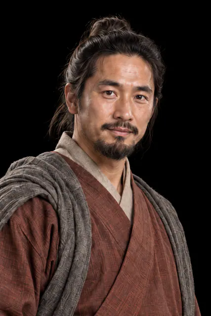
The refugee who took power
An ancient man of Yan crossed the border with followers, served Joseon and ended up occupying the throne.
Read the record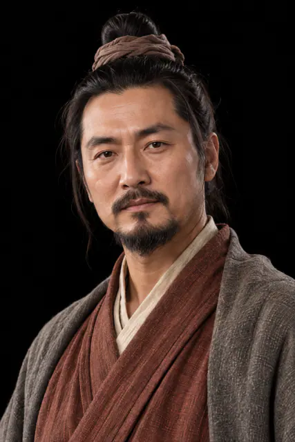
A year facing the Han
Han armies attacked by land and sea, but the city also fell through divisions among its leaders.
Read the recordLOOK CLOSER
Objects and places to start with
A selection from the destination museum. Open each record to explore its documentation and images.
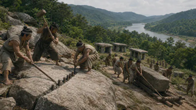
The quarry remained visible
The rocks near the dolmens allow investigation of where the slabs came from and how they could have been transported.
Read the record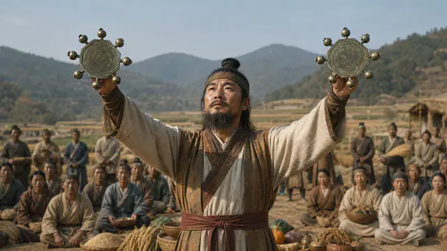
Eight voices in one hand
Eight small bells surround the central disc; moving the piece could make them sound together.
Read the record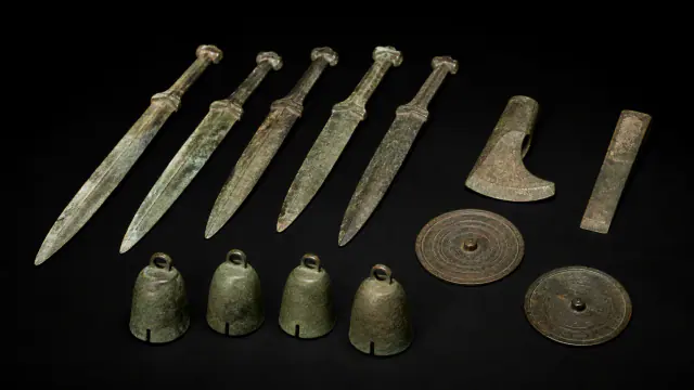
Daegok-ri grave goods
A single burial gathered daggers, tools, mirrors and ritual bronze bells.
Read the record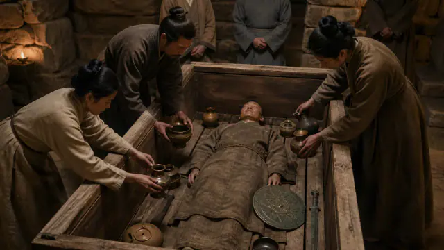
The blade became straight
A straighter, sharper blade accompanied individual burials loaded with finely worked bronzes.
Read the recordWHAT REMAINS
Its legacy and ongoing research
Offers a framework for understanding the transition towards later Korean states, keeping legendary tradition and archaeohistorical evidence separate.
CHOOSE YOUR NEXT STOP
Inside this museum
Sources for this introduction
Each theme links to its documentation. The full bibliography also brings together sources for the chronology, the people and the connection between the museums.
View all sources and references →Evidence and interpretation
This window distinguishes the documented core of its historical reach: Liaoning, southern Manchuria and the northern Korean peninsula. The label 'Gojoseon' summarises a changing trajectory, not an immobile population or a universal stage of progress.
Catalogue facts
- Narrative date
- ≈4th–3rd centuries BCE · secure historical evidence
- Location
- Liaoning, southern Manchuria and the northern Korean peninsula.
- Type of entity
- Regional state formation
- Scope
- Northwestern Korean areas and Manchuria; historical precedent for later Korean states.
- Key innovation
- Characteristic bronze daggers
- Legacy
- Offers a framework for understanding the transition towards later Korean states, keeping legendary tradition and archaeohistorical evidence separate.
A closer look
About 1 min to read · 1 section. Further reading and sources · free access. Editorial review recorded: .
The quarry allows reconstruction of work before the tomb
In Hwasun, outcrops have been identified from which stones used in the dolmens were sourced. UNESCO highlights their value for investigating extraction, transport and placement, as well as the diversity of funerary forms. The gaze no longer focuses solely on the large capstone: it also follows a work chain distributed across the landscape. These monuments provide context for the prehistory of the Korean peninsula; they should not automatically become borders of Gojoseon or tombs of rulers whose names we know. Stone, chronology and political attribution require different evidence.
- Heritage · UNESCO · Gochang, Hwasun and Ganghwa Dolmen SitesAccess recorded: .
Location and territory
DEBATED LOCATION
Liaoning, southern Manchuria and the northern Korean peninsula.Liaoning and northern Korea; the precise extent remains debated. The mark indicates the orienting centre of the scope, not a boundary or an exact point.Cultural connections
Sources and references
- UNESCO · Gochang, Hwasun and Ganghwa Dolmen Sites
- National Museum of Korea · Gojoseon gallery, Liaoning-type Bronze Dagger
- National Institute of Korean History · A History of Korea
- National Museum of Korea · Korean history
- National Museum of Korea · Gojoseon, Buyeo and Samhan gallery
- Journal of Korean Art & Archaeology · Bronze Culture of Korea
- National Museum of Korea · Bronze Axe and Songguk-ri mould
- Journal of Korean Art & Archaeology · Songguk-ri Culture and Liaoning-type daggers
- National Museum of Korea · Bronze Age gallery
- UNESCO · Dolmen Sites nomination dossier
- National Museum of Korea · Mirrors with Fine Linear Designs from Daegok-ri
- National Museum of Korea · Bronze Ritual Bells from Daegok-ri
- Academy of Korean Studies · Exploring Korean History through World Heritage
- National Museum of Korea · Chinese Coin, Myeongdojeon
- The Metropolitan Museum of Art · The Year One: Art of the Ancient World East and West
- National Institute of Korean History · Gat
- Hunan Museum · Mawangdui
YOUR NEXT VISIT
Explore Gojoseon
The same collection, two ways to explore. Choose the experience that suits you.
Did you enjoy this exhibit?
Your opinion helps us improve the museum. You can change it whenever you like.
Loading your rating…