
 English
 Español
 Français
 Italiano
 Deutsch
 Русский
 Português
 Polski
 Română
 Svenska
 Norsk bokmål
 Suomi
 Türkçe
 العربية
 简体中文
 한국어
 हिन्दी
 Ελληνικά
DOOR 01 · ASIA · EXCHANGE
Sumer
The Meluhha corridor
Continues in the Sumeria museum
Museum documentation · free public access, no account required.
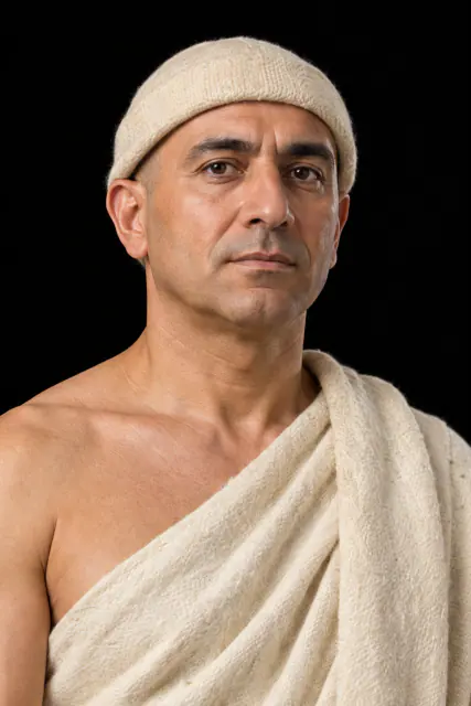
Generated reconstruction · Declared visual hypothesis
Declared visual reconstruction; not a photograph of the original nor documentary evidence.
Why this doorway leads to another museum
Seals, carnelian beads and Mesopotamian texts link Indus cities with Gulf ports and Mesopotamian centres.
Why this doorway requires caution: Routes could have included Dilmun and Magan intermediaries; not every imported object proves a direct journey.
Period of the connection: ≈2600–1900 BCE
BEFORE YOU ENTER
An introduction to Sumer
Find your place in time, explore the changes and choose where to go next.
- When
- Fourth–first millennia BCE · WESTERN ASIA
- Where
- Uruk and the alluvial plain of the Tigris and Euphrates, in present-day southern Iraq.
- What this collection brings together
- Urban network · city-states
The urbanisation of Uruk brought together temples, specialists, irrigation, administration and early writing. It was not the single origin of all cities or writing, but one of their earliest and best-documented developments.
When memory was no longer sufficient to manage grain, labour and rations, tokens, seals and tablets turned accounting into a new infrastructure of power.
PLACE MATTERS
Territory and connections
Uruk and the alluvial plain of the Tigris and Euphrates, in present-day southern Iraq. The Sumerian city-states articulated networks throughout Mesopotamia; Akkad, Babylon and Assyria appropriated and transformed much of their legacy.
A HISTORY OF CHANGE
The main periods
Dates are approximate. Periods help us navigate the past, but their boundaries were not always the same in every region.
c. 6500–3800 BCE
Ubaid villages and networks
Villages, canals, and ritual centres are connected in the southern alluvium; Ubaid is an archaeological tradition, not a proven Sumerian ethnicity.
c. 4000–3500 BCE
Urban concentration at Uruk
Uruk and other centres grow within a connected plain; the area indicates regional urbanisation, not a unitary kingdom.
c. 3500–3100 BCE
Uruk Horizon
Objects, administrative practices, and enclaves connect the south with Susiana and Upper Mesopotamia; material diffusion and colonial presence do not equate to a continuous empire.
c. 3100–2900 BCE
Jemdet Nasr and regionalisation
Uruk's extraregional network recedes, and several centres maintain or rework writing and administration.
Continue the story: 4 more periods
c. 2900–2350 BCE
Sumerian city-states
Ur, Uruk, Lagash, Kish, and other cities compete and make pacts; the envelope gathers independent polities.
c. 2334–2154 BCE
Integration into the Akkadian Empire
An Akkadian-speaking dynasty incorporates Sumerian cities; the political change does not erase local languages, cults, or offices.
c. 2112–2004 BCE
Third Dynasty of Ur
Ur recentralises much of the south and integrates neighbouring territories through provinces, tribute, and campaigns of uneven reach.
from c. 2004 BCE
Isin-Larsa and Babylonian legacies
The kingdom of Ur is divided; Sumerian ceases to be a daily language over time, but continues in schools, liturgies, and archives.
BEYOND THE DATES
How people lived and saw the world
How they were organised
Uruk was not the capital of a country called Sumeria. During the fourth millennium, it concentrated population, monumental works, and administration; in the third millennium, southern Mesopotamia was articulated by city-states with rulers, assemblies, temples, and agricultural territories that cooperated and fought.
Eanna, hierarchical images, and later the inscriptions of Gudea and Ur-Namma show that power needed to coordinate work and also explain why that coordination was legitimate. Temple, palace, and community were not identical institutions nor did they remain fixed.
What daily life was like
Most people lived among mudbrick courtyards, ovens, clay vessels, mats, and canals. Cereal, dates, legumes, fish, and livestock products sustained varied diets; beer and bread appear in texts, although an administrative list does not equate to a complete menu.
Maintenance dominated the calendar: rebuilding eroded walls, clearing silt, weaving, grinding grain, and repairing tools. Modest objects survive worse than stone and metal, so everyday life is underrepresented compared to temples and tombs.
What they knew how to do
Sumerian innovation was not a list of sudden inventions. Molded mudbrick, bitumen, reed boats, canals, potter's wheels, metallurgy, and calculation were combined and improved over centuries.
The seal and the tablet were information technologies: they made an authorisation portable and allowed an account to be reviewed. Their efficacy depended on specialists, shared conventions, and archives, not just the object.
What they believed
Sanctuaries were houses of gods and economic, ritual, and political nodes. Offerings, festivals, images, and specialised personnel sustained relationships that inhabitants considered material: feeding a deity was maintaining the order of the city.
The Uruk Vase, Enheduanna, and the statues of Gudea belong to different moments. Together they show how authority was presented as divine service, without allowing us to reduce each precinct to a single function or each image to a stable doctrine.
Who they interacted with
Southern Iraq lacked construction timber, metals, and many hard stones. Lapis lazuli, carnelian, shell, copper, and diorite arrived through chains connecting the Gulf, Iran, Anatolia, and Central Asia.
Exotic goods did not necessarily travel from a single merchant from the mine to Ur. They passed through ports, intermediaries, and alliances; their arrival transformed both prestige and local workshops.
Art, music and storytelling
Reliefs, mosaics and seals did more than decorate: they used scale to organise representations of people, animals, offerings and victory. Costly materials and repeated imagery showed who held power, who served and which relationships were meant to appear natural.
Lyres and other instruments from Ur remind us that the experience included sound and performance. What is preserved—repaired wood, metal, shell—is partial; we do not know the melodies of the Royal Cemetery or the exact context of each performance.
PEOPLE AND TESTIMONIES
Meet the people
The records distinguish historical figures, representations and reconstructions. They explain their context, the available sources and their connections with other people.
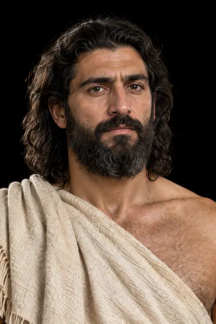
Gilgamesh
We know Gilgamesh through written accounts, but we do not have a tomb or portrait identified with certainty.
Read the record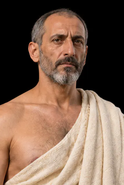
Urukagina
Urukagina claimed to have reduced abuses and burdens; his inscriptions also defended his own rule.
Read the record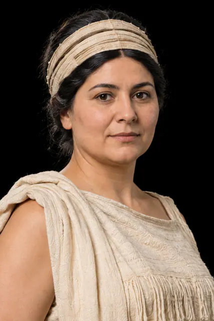
LOOK CLOSER
Objects and places to start with
A selection from the destination museum. Open each record to explore its documentation and images.
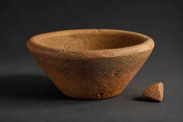
Bevel-rimmed bowl
These bowls were manufactured in large quantities, although their exact use remains in debate.
Read the record
Nippur Cubit
The markings on a rod of approximately 110 centimetres allow for the identification of a cubit measure of approximately 51.8 centimetres.
Read the record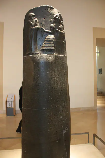
Stele of Hammurabi
Specific cases of justice accompany the image of the king before Shamash.
Read the record
WHAT REMAINS
Its legacy and ongoing research
The tablet, the city, and Mesopotamian bureaucracy survived in later great kingdoms. The most famous legal codes belong to later phases than this urban origin.
CHOOSE YOUR NEXT STOP
Inside this museum
Sources for this introduction
Each theme links to its documentation. The full bibliography also brings together sources for the chronology, the people and the connection between the museums.
View all sources and references →Evidence and interpretation
Level of evidence of connection: high. The door describes exchange; it does not convert two different cultures into one nor does it presuppose automatic ethnic continuity.
Catalogue facts
- Contact period
- ≈2600–1900 BCE
- Destination museum
- Southern Mesopotamia: Uruk and Sumerian cities
- Link Type
- exchange
- Level of evidence
- high
- Destination region
- Western Asia
A closer look
About 1 min to read · 1 section. Further reading and sources · free access. Editorial review recorded: .
The seal changes form in the Gulf
The British Museum describes Gulf circular seals that combine Harappan motifs with a form infrequent in Indus settlements themselves. Their perforated hemispheric lugs and bull images allow tracking a regional adaptation of sealing practices, linked to Bahrain. The connection to Mesopotamia thus includes objects transformed in intermediate zones. Recognising a visual tradition does not oblige attributing the whole piece to a Harappa workshop: form, material and motif can tell different circulation stories.
Location and territory
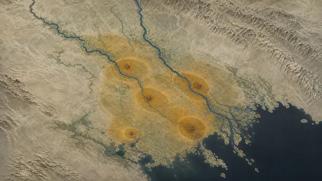
REGIONAL AREA
Southern Mesopotamia and cities of the floodplainSouthern Mesopotamia and cities of the alluvial plain. The footprint marks the indicative center of the area, not a border or an exact point.Cultural connections
Sources and references
- British Museum · Seal of the Gulf and trade of Meluhha, 1932,1008.178
- The Metropolitan Museum of Art · Late Uruk cylinder seal and impression
- Harappa Project — Unicorn sealings and seals
- The Met · Uruk and the Origin of Writing
- Deutsches Archäologisches Institut · Uruk (Warka)
- Cuneiform Digital Library Initiative · Laws of Ur-Namma composite
- The Metropolitan Museum of Art · Statue of Gudea
- British Museum · Bevelled rim bowl 1919,1011.513
- Institute for the Study of Ancient Cultures · Sumerian Agriculture Group publication
- The Metropolitan Museum of Art · Administrative account with malt and barley groats
- The Metropolitan Museum of Art · Record of irrigation work
- Metropolitan Museum Journal 55 · Study of the Uruk Vase
- Penn Museum · Disc of Enheduanna (B16665)
- Penn Museum · Queen Puabi’s Headdress
- British Museum · Iraq: Royal Cemetery of Ur
- Ashmolean Museum · Sumerian King List
- The Met · Gilgamesh, hypothetical historical horizon towards 2700 BCE
- British Museum · Epic of Gilgamesh, Tablet XI
- British Museum · Gudea
- Penn Museum · Goddesses, Mothers, Rulers
- Musée du Louvre · Cone C of Urukagina, AO 3149
- CDLI · testimony RIME 1.09.09.01
- The Metropolitan Museum of Art · Guide to Ancient Near Eastern Art
YOUR NEXT VISIT
Explore Sumer
The same collection, two ways to explore. Choose the experience that suits you.
Did you enjoy this exhibit?
Your opinion helps us improve the museum. You can change it whenever you like.
Loading your rating…