
 English
 Español
 Français
 Italiano
 Deutsch
 Русский
 Português
 Polski
 Română
 Svenska
 Norsk bokmål
 Suomi
 Türkçe
 العربية
 简体中文
 한국어
 हिन्दी
 Ελληνικά
HISTORICAL DOOR · DOCUMENTED CONTACT
Celtic Worlds
Tylis: a Celtic kingdom in Thrace
This story continues in the Celtic Worlds museum.
Museum documentation · free public access, no account required.
Contextual image · Contextual correspondence
Reverse of a Cavarus coin, with Nike and royal legend. Numismatic testimony of the kingdom of Tylis, not a portrait of the ruler. Nike is a divine figure, not the portrait of the king. Original photograph published by robertmx under CC BY-SA 4.0; do not use the discarded Commons drawing.
robertmx · CC BY-SA 4.0
Why this doorway leads to another museum
Polybius remembers a Celtic kingdom settled in Thrace and the burdens it imposed on Byzantium. The arrival of Celtic groups added actors to a region where local kings, cities and successors of Alexander were already competing.
The end of the kingdom does not erase the decades of contact. Enter the Celtic museum to explore movements and settlements without imagining all the people called Celts as a common State.
Period of the connection: 3rd century BCE
BEFORE YOU ENTER
An introduction to Celts
Find your place in time, explore the changes and choose where to go next.
- When
- ≈800–500 BCE · EUROPE AND THE AEGEAN
- Where
- Central Europe, especially the Hallstatt and La Tène archaeological areas.
- What this collection brings together
- Linguistic and Cultural Constellation
'Celtic' designates a constellation of languages, styles and peoples, not a unified empire. Their networks connected very distant regions of Europe.
Iron, prestige routes and new fortified centres enabled regional elites to articulate corridors from central Europe towards the Atlantic and the Mediterranean.
PLACE MATTERS
Territory and connections
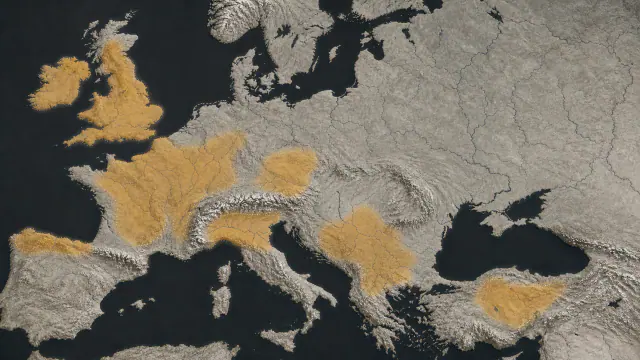
Central Europe, especially the Hallstatt and La Tène archaeological areas. Western Europe, British Isles, Iberia, Balkans and Anatolia through networks, migrations and regional formations.
A HISTORY OF CHANGE
The main periods
Dates are approximate. Periods help us navigate the past, but their boundaries were not always the same in every region.
c. 1200–800 BCE
Late Bronze Age Networks
Atlantic, Alpine and Mediterranean exchanges precede Hallstatt; a material distribution does not automatically identify a Celtic language or ethnicity.
ca. 800–450 BCE
Hallstatt
Mining, elite graves and fortified centres structure central Europe; Hallstatt is a more precise archaeological category than a Celtic state.
ca. 450–300 BCE
Early La Tène
New repertoires and group movements spread across Europe; a shared style does not demonstrate a single migration.
ca. 300–150 BCE
Regional Worlds
Gauls, Celtiberians, Britons and Galatians are distinct formations; they must never be fused into a continuous band from the Atlantic to Anatolia.
Continue the story: 3 more periods
ca. 150–50 BCE
Oppidum Network
Large settlements such as Bibracte concentrate production and politics in several regions without creating a common authority.
ca. 121 BCE–43 CE
Roman Conquests
Rome incorporates regions at different dates and under different conditions; conquest does not immediately erase languages, cults or communities.
Late Antiquity–Present
Insular Continuities
Celtic languages survive and are renewed in Atlantic regions; their modern map does not demonstrate the exact extent of ancient languages.
BEYOND THE DATES
How people lived and saw the world
How they were organised
Large barrows, statues and fortified centres indicate resource concentration and high-status positions. However, 'prince' is a modern archaeological label: it does not translate an inscribed title nor define the territorial reach of power.
In the 1st century BCE, peoples such as the Aedui held assemblies and negotiated alliances. Caesar presents chiefdoms and coalitions from the perspective of his campaign; Bibracte archaeologically shows a political capital without turning it into the capital of all Celts.
What daily life was like
Salt preserved textiles, leather and organic remains that return the physical scale of work. At Hochdorf and Vix, vessels, horns, wagons and furniture transformed drinking and mobility practices into funerary ceremonies.
Lindow Man preserves a trimmed beard, manicured nails and his last meal, an unleavened cake. It is an exceptional bodily biography, not a statistical portrait of the British population.
What they knew how to do
The mudbrick wall of Heuneburg adapted a southern technique to an Upper Danube setting. The Battersea Shield assembled repoussé sheets and red glass over an organic core; the Vix krater carried a bronze wall to only 1.2 millimetres.
These solutions are not steps in a linear progression. Each object optimised weight, appearance, repair and use-context through specific knowledge and specialist networks.
What they believed
Rivers, lakes and bogs received valuable objects and bodies. Deliberate deposition is observable in some assemblages; attributing the action to a deity, sacrifice or concrete ceremonial calendar often requires more caution.
Gundestrup was dismantled before entering the bog, while Battersea appeared in the Thames. Lindow Man suffered violence, but sacrifice, execution and crime remain alternative explanations.
Who they interacted with
Baltic amber, Mediterranean coral, Attic pottery and large bronze vessels reached inland centres. Their presence demonstrates routes and social value, but rarely allows reconstruction of a single route or knowledge of all intermediaries.
Gundestrup was probably manufactured south or southeast of Denmark and ended up dismantled in a bog. The journey and combination of techniques are the historical content, not a dispute over declaring the object purely Celtic or Thracian.
Art, music and storytelling
Curves, palmettes and animals of the so-called La Tène style travelled on metal, wood and bodies. The Battersea Shield is specifically British in form although it shares a continental ornamental grammar.
Incised dances in the Hochdorf bed and processions or hybrid beings in Vix and Gundestrup suggest performance and narration, but the images do not preserve music nor a common pantheon.
PEOPLE AND TESTIMONIES
Meet the people
The records distinguish historical figures, representations and reconstructions. They explain their context, the available sources and their connections with other people.
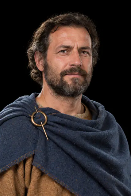
Nine Guests and an Absent One
The tomb included a bronze couch and utensils for a banquet of nine people.
Read the record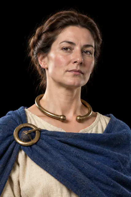
The lady and the giant krater
The largest known bronze krater travelled from Greek workshops to the tomb of a woman in inland Europe.
Read the record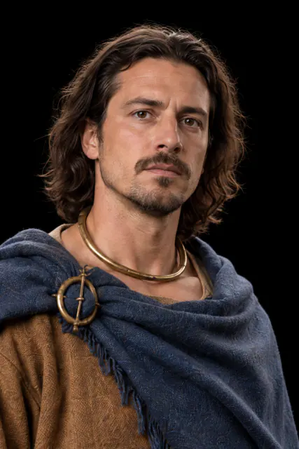
Two Walls and a Story
A Roman army built fortifications looking inward and outward; the victor wrote the most famous version.
Read the record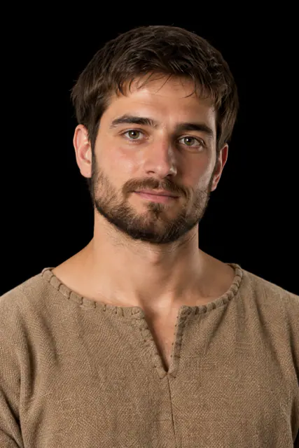
The Man Preserved in the Bog
His skin, his hair and remnants of his last meal were preserved in the bog; the motive for his death remains under discussion.
Read the recordLOOK CLOSER
Objects and places to start with
A selection from the destination museum. Open each record to explore its documentation and images.
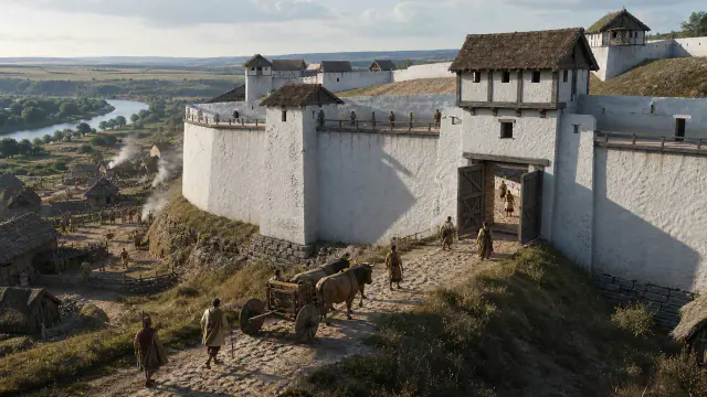
A White Wall on the Danube
A Mediterranean technique appeared north of the Alps and changed the profile of a fortified centre.
Read the record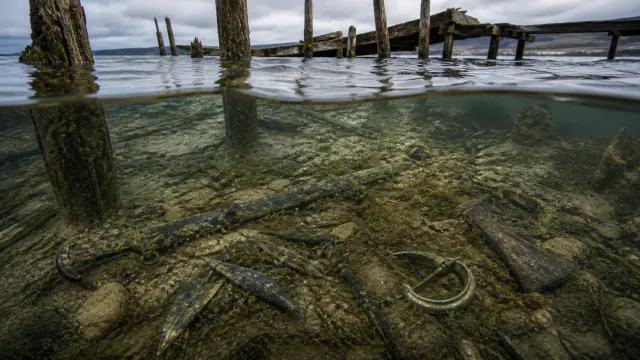
Weapons under the Lake
Beside a wooden walkway appeared weapons, tools, ornaments and human remains.
Read the record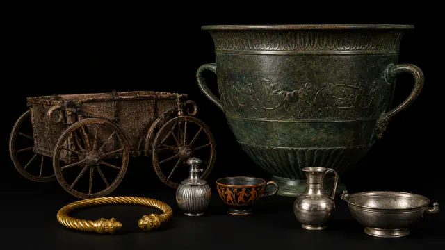
Vix Tomb
Jewellery, a wagon and tableware arriving from afar accompanied a high-status woman.
Read the record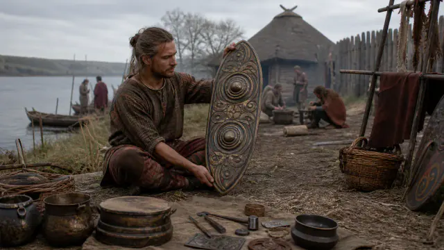
The Shield that Did Not Fight
This shield covering, decorated with red enamel, appeared in the Thames; it does not seem to be everyday combat equipment.
Read the recordWHAT REMAINS
Its legacy and ongoing research
Celtic languages, artistic traditions and archaeological landscapes endure in various regions; they do not certify a single ancient Celtic nation.
CHOOSE YOUR NEXT STOP
Inside this museum
Sources for this introduction
Each theme links to its documentation. The full bibliography also brings together sources for the chronology, the people and the connection between the museums.
View all sources and references →Evidence and interpretation
An exact capital or border for Tylis is not set here. Ancient rhetoric about the destruction of a people does not amount to a census of survivors.
Catalogue facts
- Date
- 3rd century BCE
- Location
- Thrace and relations with Byzantium; Tylis location discussed
A closer look
About 1 min to read · 1 section. Further reading and sources · free access. Editorial review recorded: .
Pay to avoid war
In Polybius's account, Byzantium pays sums and then tribute to prevent attacks. The anecdote illuminates the effect of a regional power on a commercial city: controlling the environment could be as decisive as occupying the port. It is a relationship of coercion, not a commercial alliance presented without conflict.
- Ancient text · Polybius · Histories IV, 45–46: the kingdom of TylisAccess recorded: .
Location and territory
REGIONAL AREA
Thrace and relations with Byzantium; Tylis location discussedConstellation of Regional Areas; Not a Single Territorial State. The footprint indicates the orientative centre of the area, not a boundary nor an exact point.Cultural connections
Sources and references
- Polybius · Histories IV, 45–46: the kingdom of Tylis
- Pausanias · Description of Greece I, 9–10: Lysimachus and the Getae
- Musée d'Archéologie nationale · Iron Age collections
- Keltenmuseum Hochdorf · The Museum and the Prince's Grave
- Musée du Pays Châtillonnais · Vix Treasure
- Keltenwelt · Statue of a ruler
- Bibracte EPCC · Bibracte throughout time
- UNESCO World Heritage Centre · Hallstatt-Dachstein/Salzkammergut Cultural Landscape
- British Museum · Lindow Man (1984,1002.2)
- Landesamt für Denkmalpflege Baden-Württemberg · Archaeology on the Upper Danube: Heuneburg
- British Museum · The Battersea Shield (1857,0715.1)
- National Museum of Denmark · The Gundestrup Cauldron
- British Museum · Regarding the Dead: human remains in museum practice
- University of Texas at Austin · Iron Age Celts: Hochdorf Bronze Couch
- British Museum · Who were the Celts?
- Keltenmuseum Hochdorf/Enz — Museum and burial reconstruction
- Keltenmuseum Hochdorf · The World of the Celts
- Musée du Pays Châtillonnais — Vix Treasure
- MuséoParc Alésia — The museum
- INRAP — Chronology of Gaul and the Conquest
- MuséoParc Alésia · Archaeology
- Julius Caesar · Gallic War, Book 7 (Perseus Digital Library)
- British Museum · Lindow Man
YOUR NEXT VISIT
Explore Celts
The same collection, two ways to explore. Choose the experience that suits you.
Did you enjoy this exhibit?
Your opinion helps us improve the museum. You can change it whenever you like.
Loading your rating…