
 English
 Español
 Français
 Italiano
 Deutsch
 Русский
 Português
 Polski
 Română
 Svenska
 Norsk bokmål
 Suomi
 Türkçe
 العربية
 简体中文
 한국어
 हिन्दी
 Ελληνικά
INDO · URBANISATION
Indus Valley Civilisation
Harappa before the great city
Harappa allows us to follow the growth of a settlement until it became a great city.
Museum documentation · free public access, no account required.
Generated reconstruction · Declared visual hypothesis
Declared visual reconstruction, created for museographic contextualisation; not a photograph of the original nor does it constitute documentary evidence.
Why this doorway leads to another museum
Harappa did not appear suddenly as a perfect grid. Under its mounds, more than thirteen metres of occupation have accumulated. Between 3300 and 2600 BCE, agricultural villages grew, connected via the routes of the Ravi, and raised one layer of mudbrick architecture over another.
From approximately 2600 BCE, and clearly by 2500, the mature urban scale associated with Harappa and Mohenjo-Daro appears: planned streets, standardised bricks, and drainage systems. Its system of signs remains undeciphered, so we know much of its engineering and very little of the words with which they explained their world.
Period covered by the destination museum: c. 2600 BCE · antecedents from c. 3300
BEFORE YOU ENTER
An introduction to Indus
Find your place in time, explore the changes and choose where to go next.
- When
- c. 2600 BCE · antecedents from c. 3300 · SOUTH ASIA
- Where
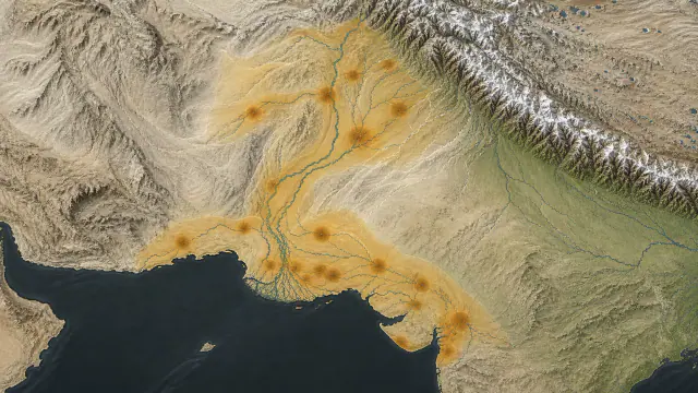
- Harappa, Mohenjo-daro, Dholavira and an extensive network between Punjab, Sindh, Baluchistan and Gujarat.
- What this collection brings together
- Urban network · archaeological culture
A vast urban network combined planning, standardization and water management without us yet knowing the language of its signs. Material uniformity does not prove a centralized empire.
By c. 2600 BCE, settlements with centuries of history converged into a mature urban system of bricks, weights and surprisingly coherent hydraulic solutions.
PLACE MATTERS
Territory and connections
Harappa, Mohenjo-daro, Dholavira and an extensive network between Punjab, Sindh, Baluchistan and Gujarat. From present-day Pakistan to the northwest and west of India, with connections towards Mesopotamia and the Persian Gulf.
A HISTORY OF CHANGE
The main periods
Dates are approximate. Periods help us navigate the past, but their boundaries were not always the same in every region.
c. 3300–2600 BCE
Harappan regionalization
Centres in Punjab, Sindh and neighbouring regions develop urbanism and crafts with local rhythms; the network has no known capital.
c. 2600–2300 BCE
Early mature phase
Large cities share weights, seals, bricks and hydraulic solutions without proving a centralized empire.
c. 2300–2000 BCE
Maximum extent of the network
The mature material tradition reaches its greatest dispersion from Baluchistan and Punjab to Gujarat and the Gulf of Oman.
c. 2000–1900 BCE
Urban reorganization
Several major centres lose population and some standardized forms diminish, while other cities continue.
Continue the story: 1 more period
c. 1900–1300 BCE
Post-urban traditions
Smaller settlements and regional traditions continue; decentralization does not mean sudden disappearance nor does it identify a successor language.
BEYOND THE DATES
How people lived and saw the world
How they were organised
Streets, walls, hydraulic works and standards imply coordination, but no building has been universally accepted as a royal palace. Power may have been distributed among institutions, neighbourhoods, lineages and specialists in ways we cannot name today.
The absence of legible inscriptions forces us to start with material decisions: who maintained a drain, controlled a gate or authorized a weight. These questions are more precise than inventing a Harappan emperor.
What daily life was like
Wells, baths, channels and courtyards integrated water into many homes in Mohenjo-daro. The infrastructure only functioned if it was cleaned, repaired, and access between private spaces and streets was negotiated.
Food, textiles, toys, pottery and waste reveal lives broader than the famous drainage systems. Access to water and construction quality varied between neighbourhoods and cities.
What they knew how to do
Drilling carnelian, firing steatite, working shell and raising bricks required specialised chains of operations. Heat control changed colour and hardness; fine drills pierced beads of great length.
Dholavira adds stone masonry and water capture to a repertoire that was not uniform. Technologies circulated, but each workshop adapted raw materials and local tradition.
What they believed
Seals, figurines, baths and burials were used to propose gods and rites. Without deciphered texts, archaeology can describe gestures and contexts, but cannot assign names or doctrines.
The funerary structures of Dholavira, many of which contain no human remains and are therefore interpreted as cenotaphs, show investment in memory. Their variety speaks of diverse practices, not of a uniform Harappan religion reconstructed from a single tomb.
Who they interacted with
Carnelian, shell, seals and other goods connected Gujarat and the Indus Valley with Oman, Dilmun and Mesopotamia. Mesopotamian texts name Meluhha, but the exact territory and each itinerary require caution.
The Lothal basin has been presented as a dock, although hydraulic functions are also discussed. Maritime trade is documented regionally without relying on that structure being a port.
Art, music and storytelling
Seals, small sculptures, beads and bangles allow us to understand the work of Indus artisans. The variety of materials shows a very precise attention to colour, shine and form.
A figure in a specific posture is not enough to know what dance it represents. We can study the objects and compare them, but we cannot safely reconstruct a specific music or ceremony.
PEOPLE AND TESTIMONIES
Meet the people
The records distinguish historical figures, representations and reconstructions. They explain their context, the available sources and their connections with other people.
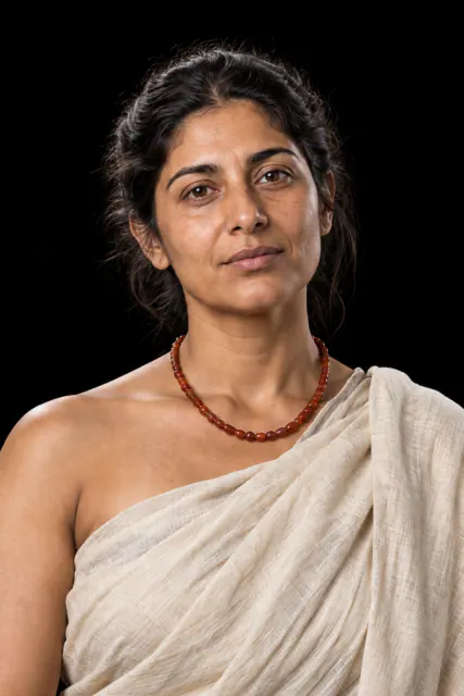
Nahara · fictional name
Nahara is a fictional character who raises the question of how to organise the distribution and care of water.
Read the record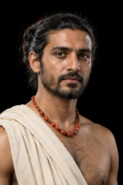
Ravi · fictional name
The fictional artisan Ravi helps to understand the work of manufacturing carnelian beads for exchange.
Read the recordLOOK CLOSER
Objects and places to start with
A selection from the destination museum. Open each record to explore its documentation and images.
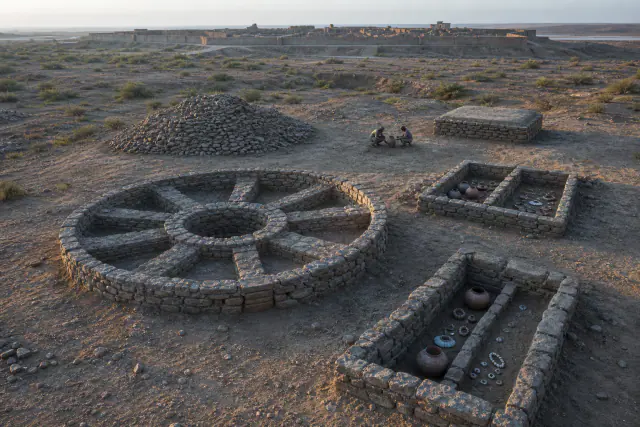
Cemetery
Many funerary structures at Dholavira do not preserve bodies and are interpreted as commemorative monuments.
Read the record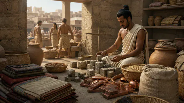
Weights
The weights followed repeated measures that allowed quantities to be compared in exchanges.
Read the record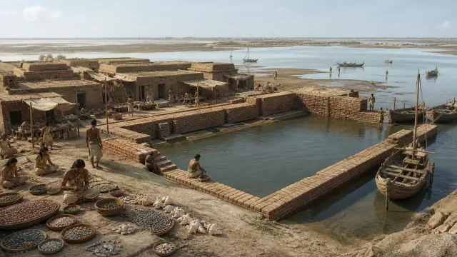
Lothal
The large brick basin at Lothal has been interpreted as a dock, although its function is debated.
Read the record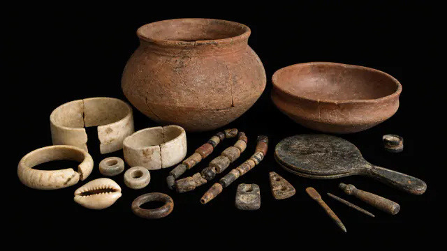
Cemetery R-37
The graves of R-37 contained pottery, bangles and beads; some also included mirrors.
Read the recordWHAT REMAINS
Its legacy and ongoing research
Their urban and craft traditions are part of the long history of the subcontinent, but they do not allow for tracing a simple political or linguistic continuity.
CHOOSE YOUR NEXT STOP
Inside this museum
Sources for this introduction
Each theme links to its documentation. The full bibliography also brings together sources for the chronology, the people and the connection between the museums.
View all sources and references →Evidence and interpretation
The stratigraphy and the Ravi, Kot Diji, and Mature Harappan phases are documented. To speak of an inevitable path to the city would be retrospective; the Indus script continues without an accepted reading.
Catalogue facts
- Date
- Ravi ≈3300–2800 · maturity from ≈2600 BCE
- Location
- Harappa, Punjab · present-day Pakistan
- Materials
- Mudbrick, pottery, copper, and stone for beads
- Record
- More than 13 m of archaeological sequence
- Urban planning
- Standardized brick and drainage in the mature phase
- Writing
- System of signs still undeciphered
A closer look
About 1 min to read · 1 section. Further reading and sources · free access. Editorial review recorded: .
The agreement was within the scale
Jonathan Mark Kenoyer places the earliest standardized weights of Harappa in the Kot Diji phase, approximately between 2800 and 2600 BCE. A weight from mound AB appeared associated with dated hearths and other indications of administrative control, such as seals and a clay impression. This association helps to understand urban growth before its maximum extent. Building with bricks of regular proportions and comparing goods with shared weights allowed for the coordination of different activities. The uniformity of the measures is material evidence; it does not preserve the name of an authority that imposed them.
- Research · Jonathan Mark Kenoyer · Measuring the Harappan World, 2010Access recorded: .
Location and territory
LOCATED SITE
Harappa · PakistanMarker of the urban site.Cultural connections
Sources and references
- UNESCO · Harappa archaeological site
- Metropolitan Museum · South Asia
- Jonathan Mark Kenoyer · Measuring the Harappan World, 2010
- UNESCO — Dholavira: a Harappan City
- UNESCO Tentative List — Rehman Dheri
- Harappa Archaeological Research Project — 1994–1995 excavations
- UNESCO — Archaeological Ruins at Moenjodaro
- The Met · South Asia, 2000–1000 B.C.
- Metropolitan Museum — Art of the First Cities
- British Museum — Indus Valley Civilisation collection scope
- Harappa Project — Cemetery R37 dental study
- British Museum — Harappan stamp-seal and Gulf connections
- UNESCO Tentative List — Archaeological remains of a Harappa Port-Town, Lothal
- Harappa Project — Unicorn sealings and seals
- Archaeological Survey of India / UNESCO — Dholavira nomination dossier
- Harappa · archaeologists on Indus textiles
YOUR NEXT VISIT
Explore Indus
The same collection, two ways to explore. Choose the experience that suits you.
Did you enjoy this exhibit?
Your opinion helps us improve the museum. You can change it whenever you like.
Loading your rating…