
 English
 Español
 Français
 Italiano
 Deutsch
 Русский
 Português
 Polski
 Română
 Svenska
 Norsk bokmål
 Suomi
 Türkçe
 العربية
 简体中文
 한국어
 हिन्दी
 Ελληνικά
AFRICA · OASIS NETWORK · SAHARAN POLITICAL FORMATION
Garamantes
Garamantes of Fezzan
The Garamantes built underground channels to obtain water and cultivate in the oases of the Sahara.
Museum documentation · free public access, no account required.
Generated reconstruction · Declared visual hypothesis
Declared visual reconstruction, created for museographic contextualisation; not a photograph of the original nor does it constitute documentary evidence.
Why this doorway leads to another museum
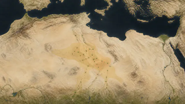
The Garamantes transformed a hyper-arid landscape through mudbrick settlements, oasis agriculture and underground water-capture galleries called foggaras. The 2022 archaeological synthesis maps over 2,000 km of networks and around 100 km² of relict fields; their world belies the idea of an empty Sahara between Rome and sub-Saharan Africa.
By channelling fossil water through tunnels of minimal gradient, communities of the Fezzan turned geological knowledge, coordinated labour and daily maintenance into the infrastructure of a desert power. Rome fought, negotiated and traded with the Garamantes; possible routes linked Amazigh communities and Sahelian societies, though destinations, goods and continuity remain debated. Roman sources are external and often hostile, so they must be cross-checked with archaeology and palaeoenvironment.
Period covered by the destination museum: ≈1000 BCE–700 CE
BEFORE YOU ENTER
An introduction to Garamantes
Find your place in time, explore the changes and choose where to go next.
- When
- ≈1000 BCE–700 CE · AFRICA
- Where
- Wadi al-Ajal and Garama/Jarma, in the Fezzan of present-day south-west Libya.
- What this collection brings together
- Oasis network · Saharan political formation
The Garamantes transformed a hyper-arid landscape through mudbrick settlements, oasis agriculture and underground water-capture galleries called foggaras. The 2022 archaeological synthesis maps over 2,000 km of networks and around 100 km² of relict fields; their world belies the idea of an empty Sahara between Rome and sub-Saharan Africa.
By channelling fossil water through tunnels of minimal gradient, communities of the Fezzan turned geological knowledge, coordinated labour and daily maintenance into the infrastructure of a desert power.
PLACE MATTERS
Territory and connections
Wadi al-Ajal and Garama/Jarma, in the Fezzan of present-day south-west Libya. Oases and trans-Saharan corridors connected towards the Mediterranean, the Sahel and the Nile Valley; their reach was a network, not a uniform frontier.
A HISTORY OF CHANGE
The main periods
Dates are approximate. Periods help us navigate the past, but their boundaries were not always the same in every region.
III–II millennia BCE
Oasis pastoral antecedents
Aridification concentrates mobility and settlements in oases; rock art does not draw a Garamantian frontier.
c. 1000–500 BCE
Fezzan Settlements
Settlements, agriculture and hierarchies precede the consolidation of Garama; not all can be attributed to a single authority.
c. 500 BCE–1 CE
Consolidation of Garama
Garama articulates oases, agriculture and corridors; a network of tribute and mobility does not require a continuous frontier.
1st–3rd centuries CE
Foggaras and Maximum Visibility
Urbanism, irrigated fields and contacts with Rome and the Sahel reach high visibility; routes are possibilities for circulation, not permanent control.
Continue the story: 2 more periods
c. 300–500 CE
Late Reconfiguration
Hydrological, commercial and political changes reduce some fields and centres; no single cause explains the process.
c. 500–700 CE and after
Oasis Continuities
Authorities and routes change without the sudden disappearance of population, hydraulic knowledge or Amazigh communities.
BEYOND THE DATES
How people lived and saw the world
How they were organised
Old Jarma became an urban centre and Mediterranean sources called it a capital, but archaeology distinguishes phases and networks rather than fixed borders.
Infrastructure, settlements and monuments suggest uneven coordination. They do not prove identical administration over a millennium.
What daily life was like
Houses, seeds, pottery and canals bring repeated activities closer that classical sources barely describe.
Urban and agricultural life coexisted with regional mobility; no single house or diet represents the entire Fezzan population.
What they knew how to do
Earthen architecture required repair; foggaras required gradient, ventilation and cleaning; pottery and metal required distinct technical chains.
Sophistication is documented in layouts and residues; it does not need an inventor attributed nor all knowledge imported from Persia or Rome.
What they believed
Diverse tombs, figurines and possible inscriptions allow investigation of symbolic practices without knowing a complete list of deities.
Architectural or graphic resemblance connects repertoires, but does not prove the shared meaning that a visual reconstruction might suggest.
Who they interacted with
Glass, amphorae and Mediterranean tableware reached the Fezzan, while Saharan products and intermediaries circulated towards other markets.
An object’s provenance proves material connection; route, price, cargo and political dominion require additional evidence.
Art, music and storytelling
Acacus reminds us that the regional visual archive began long before Garama. Garamantian figurines and monuments belong to later and distinct contexts.
No Garamantian soundtrack survives, and rock art scenes should not be animated as literal illustration of classical texts.
PEOPLE AND TESTIMONIES
Meet the people
The records distinguish historical figures, representations and reconstructions. They explain their context, the available sources and their connections with other people.

Aman · fictional name
Open first the channel feeding more fields or the one sustaining those who cannot wait another day?
Read the record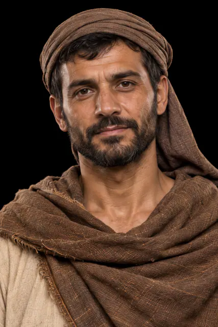
Tasam · fictional name
How far do you extend a gallery when every metre brings water closer and multiplies the risk of collapse?
Read the recordLOOK CLOSER
Objects and places to start with
A selection from the destination museum. Open each record to explore its documentation and images.
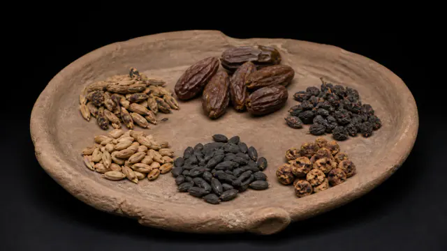
Seeds of the oasis
Plant remains show that cereals and fruit trees were already cultivated in the earliest oases.
Read the record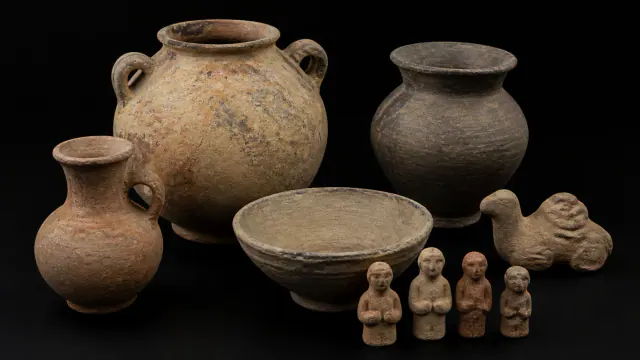
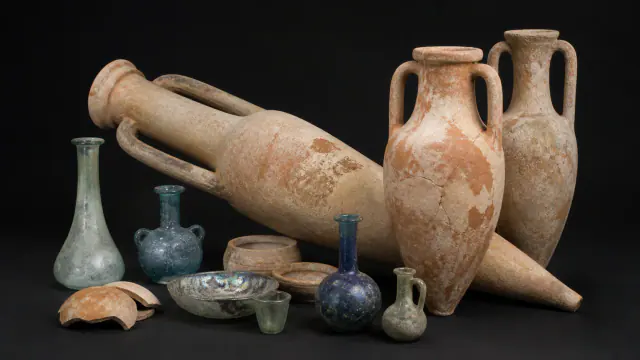
Travelling objects
Glass and amphorae show exchanges with the Mediterranean, not necessarily Roman government over the oases.
Read the record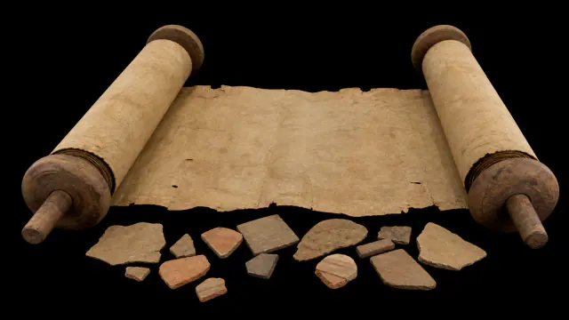
Voices from outside
Their accounts offer an external perspective that we can cross-reference with the excavated fields, houses and tombs.
Read the recordWHAT REMAINS
Its legacy and ongoing research
Garama, the necropoleis and the foggaras preserve the history of a distinct Saharan urbanisation. Hydrological, political and commercial changes played a part in its transformation, but no single cause or sudden cultural disappearance has been proven.
CHOOSE YOUR NEXT STOP
Inside this museum
Sources for this introduction
Each theme links to its documentation. The full bibliography also brings together sources for the chronology, the people and the connection between the museums.
View all sources and references →Evidence and interpretation
This window distinguishes the documented core from its historical reach: Wadi al-Ajal and Garama/Jarma, in the Fezzan of present-day south-west Libya. The label 'Garamantes' summarises a changing trajectory, not a static population nor a universal stage of progress.
Catalogue facts
- Narrative date
- ≈1000 BCE–700 CE
- Location
- Wadi al-Ajal and Garama/Jarma, in the Fezzan of present-day south-west Libya.
- Type of entity
- Oasis network · Saharan political formation
- Scope
- Oases and trans-Saharan corridors connected towards the Mediterranean, the Sahel and the Nile Valley; their reach was a network, not a uniform frontier.
- Key innovation
- Underground water systems or foggaras
- Legacy
- Garama, the necropoleis and the foggaras preserve the history of a distinct Saharan urbanisation. Hydrological, political and commercial changes played a part in its transformation, but no single cause or sudden cultural disappearance has been proven.
A closer look
About 1 min to read · 1 section. Further reading and sources · free access. Editorial review recorded: .
The lifespan of an oasis is investigated seed by seed
Ruth Pelling's archaeobotanical research traces between two thousand five hundred and three thousand years of Garamantian and post-Garamantian agricultural activity in the Fezzan. The long occupation of Jarma demands an explanation of adaptation, not merely the initial construction of water galleries. Comparing plant remains from different periods and sites allows investigation of crop changes, subsistence and commercial opportunities in a progressively arid Sahara. The monumental ruins show part of that organisation; the plant remains allow us to ask what sustained their inhabitants and how their decisions changed over time.
Location and territory
REGIONAL AREA
Garama/Jarma · FezzanMarker of the urban core and oasis corridor, not of an imperial frontier.Cultural connections
Sources and references
- ISAC Chicago · Garamantian hydraulic landscape
- UNESCO · Tadrart Acacus
- Ruth E. Pelling · UCL, Agriculture and trade amongst the Garamantes and the Fezzanese, doctoral thesis, 2007
- Society for Libyan Studies / JSTOR · Archaeology of Fazzan, vol. 4
- Cambridge University Press · Garamantian oasis settlements
- Perseus · Herodotus Book IV
- Libyan Studies · plant remains from Zinchecra
- Society for Libyan Studies / JSTOR · Archaeology of Fazzan, vol. 3
- The Archaeology of Fazzan · open synthesis
- Centre de Recherche Berbère · écriture libyco-berbère
- Mattingly et al. (2010), DMP IX, Libyan Studies 41, 89–104, excavation report; DOI 10.1017/S0263718900000285
- University of Southampton, institutional repository DMP IX
- British Museum · Roman leather shoe
YOUR NEXT VISIT
Explore Garamantes
The same collection, two ways to explore. Choose the experience that suits you.
Did you enjoy this exhibit?
Your opinion helps us improve the museum. You can change it whenever you like.
Loading your rating…