
 English
 Español
 Français
 Italiano
 Deutsch
 Русский
 Português
 Polski
 Română
 Svenska
 Norsk bokmål
 Suomi
 Türkçe
 العربية
 简体中文
 한국어
 हिन्दी
 Ελληνικά
DOOR 03 · ASIA · CONTACT
Phoenicia
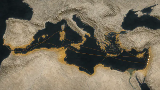
The Phoenician fleet of the empire
Continues in the Phenicia museum
Museum documentation · free public access, no account required.
Generated reconstruction · Declared visual hypothesis
Declared visual reconstruction; not a photograph of the original nor documentary evidence.
Why this doorway leads to another museum
Phoenician cities contributed naval experience and ships to the Achaemenids while retaining local political structures.
Why this door requires caution: The cooperation developed within an unequal imperial relationship and varied between cities and reigns.
Period of the connection: 6th–4th centuries BCE
BEFORE YOU ENTER
An introduction to Phoenicia
Find your place in time, explore the changes and choose where to go next.
- When
- ≈1200 BCE · WESTERN ASIA
- Where
- Tyre, Sidon, Byblos, and other cities on the Levantine coast, especially in present-day Lebanon.
- What this collection brings together
- Port cities · maritime network
Phoenician cities built power through navigation, manufactures, and trading enclaves rather than through continuous territorial conquest.
Following the Late Bronze Age crises, Levantine ports expanded routes and settlements until the Mediterranean became a shared infrastructure.
PLACE MATTERS
Territory and connections
Tyre, Sidon, Byblos, and other cities on the Levantine coast, especially in present-day Lebanon. Cyprus, North Africa, Sicily, Sardinia, and Iberia through trading posts, settlements, and naval routes.
A HISTORY OF CHANGE
The main periods
Dates are approximate. Periods help us navigate the past, but their boundaries were not always the same in every region.
c. 1500–1200 BCE
Canaanite ports of the Late Bronze Age
Byblos, Sidon, Tyre, and other ports participated in eastern networks before the exonym 'Phoenician' existed.
c. 1200–1000 BCE
Phoenician cities
After the Bronze Age crisis, coastal cities reorganised their networks while maintaining their own authorities.
c. 1000–814 BCE
Maritime expansion
Tyre and other ports sustained routes and settlements towards Cyprus and the Mediterranean; the sea should not be coloured as sovereign territory.
c. 814–650 BCE
Western foundations and Carthage
Western settlements grew through distinct processes; Carthage soon acquired its own political trajectory.
Continue the story: 2 more periods
c. 650–332 BCE
Imperial Levant and Punic sphere
Assyria, Babylon, and Persia limited Levantine autonomy while Carthage expanded its western sphere; these are parallel histories, not a single Phoenician empire.
332–146 BCE
Hellenistic conquests and Punic Wars
Levantine cities entered Hellenistic kingdoms; Carthage lost its sphere after wars with Rome and was destroyed in 146 BCE.
BEYOND THE DATES
How people lived and saw the world
How they were organised
Byblos, Tyre, and Sidon were urban kingdoms with dynasties, sanctuaries, and their own agendas. They cooperated or competed with one another while negotiating tribute, trade, and autonomy against Assyria, Babylon, and the Achaemenid Empire.
The inscription of Eshmunazar and the Balawat Assyrian band show two scales of power: the local king who lists works and concessions, and the imperial sovereign who turns coastal tribute into an image of victory. Neither accredits a unitary Phoenician state.
What daily life was like
Cordage, a basket, a hand mill, and hull repairs bring the life of a crew closer than a list of kings. On land, piles of shells and waste returned the smell, effort, and risk to the colour purple.
Written archives privilege palaces, temples, and transactions; homes, childhood, and servile work appear unevenly. Everyday archaeology allows questions to be formulated, though it rarely names those who left those remains.
What they knew how to do
Mazarrón 1 combined cypress, pine, fig, and olive according to the properties of each piece, with sewn joints and resin to seal the hull. Naval technology was accumulated material knowledge, repairable and adapted to Mediterranean resources.
Extracting dye from murex and reducing a script to a consonantal series belong to different fields, but share expert transmission. No innovation needed to emerge complete from a single city to transform wide networks.
What they believed
Ahiram protects his tomb through a written formula, while Eshmunazar lists sanctuaries linked to the royal house of Sidon. Religion, dynastic memory, and urban construction appear united, not separated into a private sphere.
Each city maintained its own cults and combinations, which changed as they circulated through Cyprus, North Africa, and the Iberian Peninsula. Greek or Roman equivalences partially translate these powers, but do not preserve their meanings intact.
Who they interacted with
Small ships could link coastal stops and redistribute cargo between ports, rather than always completing a direct crossing from the Levant. Ingots, ivory, pottery, and perfumes from the Bajo de la Campana condense different origins in a single hull.
Western foundations functioned through agreements, conflict, and mixing with local communities. The circulation of goods was not a one-way arrow from active colonisers to passive receivers.
Art, music and storytelling
Phoenician craftsmen worked ivory, metal, glass, and other materials for clients from different regions of the Mediterranean. Their objects combine motifs that also appear in Egypt and the Near East.
These similarities help track contacts and commissions. They do not mean that workshops were limited to copying: they adapted forms, techniques, and images to local tastes and uses.
PEOPLE AND TESTIMONIES
Meet the people
The records distinguish historical figures, representations and reconstructions. They explain their context, the available sources and their connections with other people.
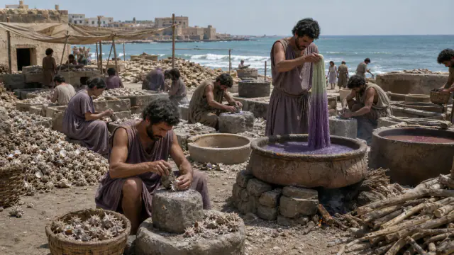
Purple by hammer blows
Producing purple dye required processing thousands of molluscs and left large quantities of shells.
Read the record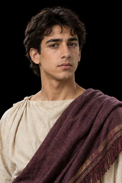
Eshmunazar
The sarcophagus of the king of Sidon combines stone of Egyptian origin and a long Phoenician inscription.
Read the record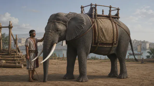
Punic elephant
Feeding, loading, and driving an elephant required infrastructure that began long before the battle.
Read the record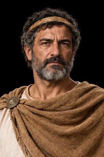
Syphax of Numidia
The Numidian king Syphax intervened in the alliances between Carthage and Rome and was defeated by Masinissa and Scipio.
Read the recordLOOK CLOSER
Objects and places to start with
A selection from the destination museum. Open each record to explore its documentation and images.
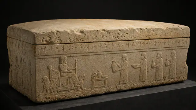
The voice of Ahiram
The inscription identifies Ahiram and threatens whoever opens his tomb.
Read the record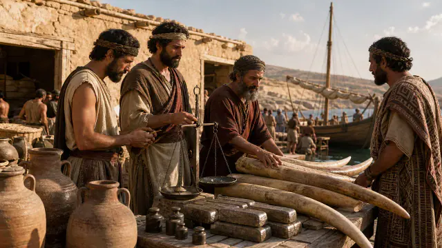
Ivory with names
Before becoming a comb or luxury plaque, ivory crossed the sea as marked raw material.
Read the record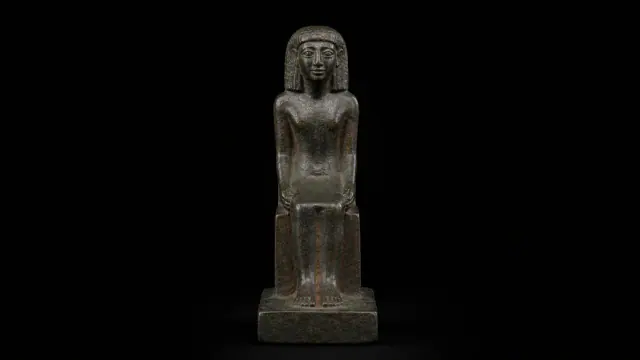
Astarte from El Carambolo
A Phoenician inscription dedicates this figure, found at El Carambolo, to Astarte.
Read the record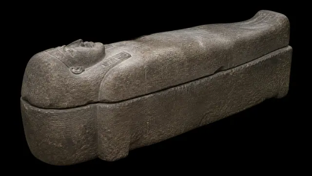
Sarcophagus of Eshmunazar
The inscription on the sarcophagus of Eshmunazar commemorates the king and warns against disturbing his tomb.
Read the recordWHAT REMAINS
Its legacy and ongoing research
The Phoenician alphabet decisively influenced Greek and later scripts; Carthage turned its maritime experience into its own political power.
CHOOSE YOUR NEXT STOP
Inside this museum
Sources for this introduction
Each theme links to its documentation. The full bibliography also brings together sources for the chronology, the people and the connection between the museums.
View all sources and references →Evidence and interpretation
Level of evidence of connection: high. The door describes contact; it does not convert two different cultures into one nor does it presuppose automatic ethnic continuity.
Catalogue facts
- Contact period
- 6th–4th centuries BCE
- Destination museum
- Phoenicia
- Link Type
- contact
- Level of evidence
- high
- Destination region
- Western Asia
A closer look
About 1 min to read · 1 section. Further reading and sources · free access. Editorial review recorded: .
A province did not annul all local authorities
The administrative region called Eber-Nāri brought together territories west of the Euphrates with different statutes. Tyre, Sidon, Byblos and Arados retained hereditary kings and minted silver coin, although their power was limited by the Persian satrap and by local institutions. Their naval resources had to be placed at the king's service in military campaigns. The same structure thus combined urban monarchies and imperial subordination. The Phoenician door is better understood through this superimposition of authorities and obligations than as a unified fleet belonging to a politically homogeneous people.
- Research · Encyclopaedia Iranica · Eber-NāriAccess recorded: .
Location and territory
REGIONAL AREA
Levantine cities; the routes and colonies do not equate to a state frontierLevantine cities; the routes and colonies do not equate to a state frontier. The footprint indicates the orientative centre of the area, not a frontier nor an exact point.Cultural connections
Sources and references
- The Metropolitan Museum of Art · The Achaemenid Persian Empire (550–330 B.C.)
- The Met · The Phoenicians (1500–300 B.C.)
- Encyclopaedia Iranica · Achaemenid Dynasty, Culture
- Encyclopaedia Iranica · Eber-Nāri
- UNESCO World Heritage Centre · Tyre
- Musée du Louvre · Sarcophagus of Eshmunazar II
- British Museum · Balawat Gates band Rm 1041
- Museo Nacional de Arqueología Subacuática · Mazarrón 1 ship
- Museo Nacional de Arqueología Subacuática · Mazarrón 2 ship
- British Museum · bilingual Phoenician-Greek base
- UNESCO · Byblos
- UNESCO · Archaeological Site of Carthage
- Museo Nacional de Arqueología Subacuática · Bajo de la Campana
- The Met · Furniture plaque with Egyptianizing figures from Nimrud
- The Met · The Phoenicians
- British Museum · Phoenician
- Louvre · Sarcophage d’Eshmunazor
- University of Chicago · Polybius, Histories III
- British Museum · coin attributed to Syphax, 1938,0510.124
- The Met · Chiton, Peplos, Himation
- British Museum · Roman leather shoe
YOUR NEXT VISIT
Explore Phoenicia
The same collection, two ways to explore. Choose the experience that suits you.
Did you enjoy this exhibit?
Your opinion helps us improve the museum. You can change it whenever you like.
Loading your rating…