
 English
 Español
 Français
 Italiano
 Deutsch
 Русский
 Português
 Polski
 Română
 Svenska
 Norsk bokmål
 Suomi
 Türkçe
 العربية
 简体中文
 한국어
 हिन्दी
 Ελληνικά
ARCHITECTURE AND LANDSCAPE · 03
Jebel Barkal, Nuri and Meroe
Sacred mountain, pyramids, and cities marked distinct phases of the kingdom of Kush.
Museum documentation · free public access, no account required.
Reconstruction · Declared visual hypothesis
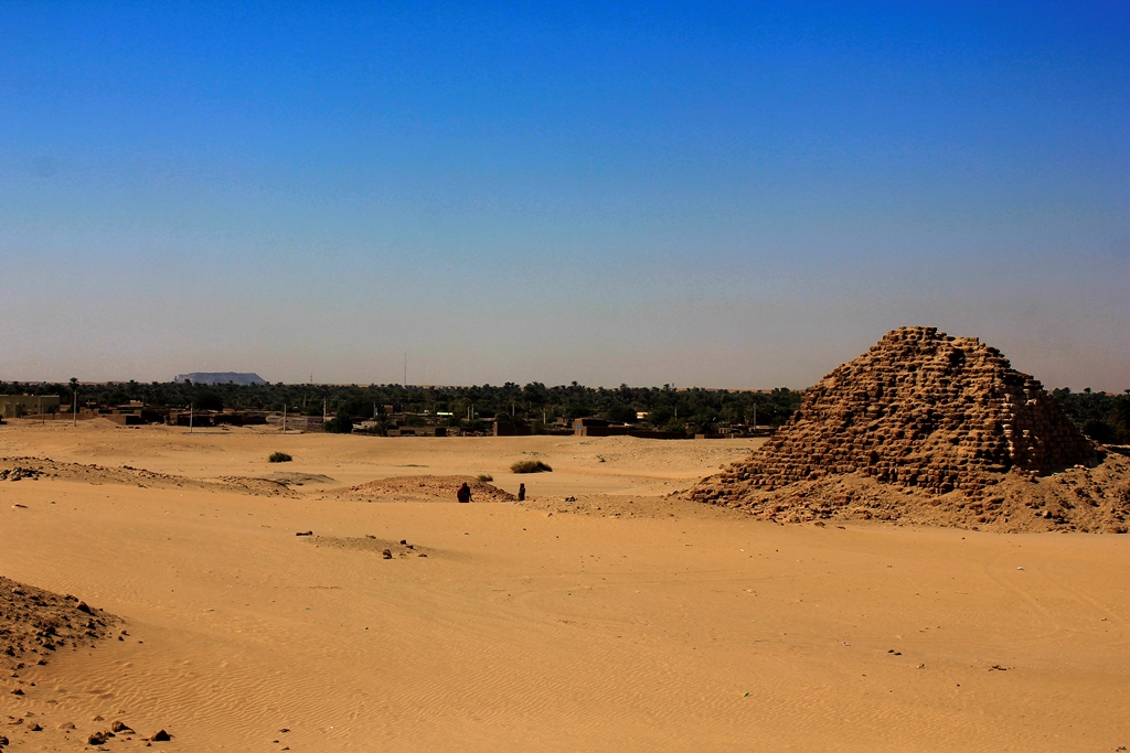
Partial AI reconstruction with substantial changes to the framing, reconstruction of masonry and removal of modern elements, based on a photograph by Clemens Schmillen, CC BY-SA4.0; this does not imply the photographer’s endorsement. The summit is excluded because of historical uncertainty.
Tracekeepers / OpenAI ImageGen; photographic reference: Clemens Schmillen · CC BY-SA 4.0
History and context
Their small pyramids are not late imitations lacking their own agency.
Evidence and interpretation
Synthesis based on UNESCO · Gebel Barkal; UNESCO · Meroe; The Met · Kerma. The comparison serves to formulate questions, not to fill gaps in the record with certainties.
Catalogue facts
- Civilisation or trajectory
- Nubia: Kerma and Kush
- Scope
- Memory, Technique and Conservation
- Main area
- The Upper Nile of present-day Sudan: Kerma and, later, Napata and Meroe.
A closer look
About 1 min to read · 1 section. Further reading and sources · free access. Editorial review recorded: .
Water reservoirs are monuments too
Meroe's heritage includes water management installations besides cult buildings and tombs. UNESCO highlights the value of these deposits for reconstructing the hydrological regime and environmental changes of the last centuries BCE and first centuries CE. Their presence gains special importance when comparing the city beside the Nile with the interior semi-desert centres. In this landscape, a sanctuary's functioning also depended on resources and maintenance: the pyramids alone do not tell how occupation was sustained.
- Heritage · UNESCO · Archaeological Sites of the Island of MeroeAccess recorded: .
Reference images and provenance
 View full-size photograph ⛶
Photo of the conserved state, 1 January 2017. Serves as topographic and material reference; does not prove the full elevation.
· Contextual correspondence
Clemens Schmillen

Location and territory
REGIONAL AREA
Upper Nile Corridor; Kerma, Napata and Meroe were not a single StateUpper Nile Corridor; Kerma, Napata and Meroe were not a single State. The footprint marks the indicative center of the area, not a border or an exact point.Sources and references
Did you enjoy this exhibit?
Your opinion helps us improve the museum. You can change it whenever you like.
Loading your rating…