
 English
 Español
 Français
 Italiano
 Deutsch
 Русский
 Português
 Polski
 Română
 Svenska
 Norsk bokmål
 Suomi
 Türkçe
 العربية
 简体中文
 한국어
 हिन्दी
 Ελληνικά
ARCHITECTURE AND LANDSCAPE · 01
The Deffufa of Kerma
A huge mudbrick building dominated the city.
Museum documentation · free public access, no account required.
Reconstruction · Declared visual hypothesis
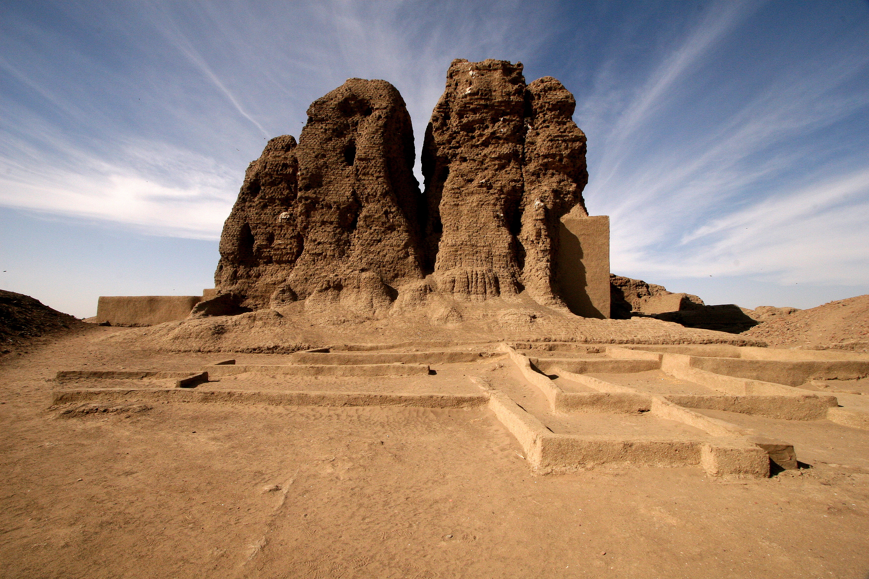
Visual hypothesis of the monument in use around 1600–1500 BCE, based on a photograph by walter callens (CC BY2.0) and publications of the Kerma mission. The heights, upper architectural details and finish are not a metrically verified reconstruction. The building has been completed and erosion removed in the image; it is not a photograph of the original monument and does not imply the photographer’s endorsement.
TRACEKEEPERS · OpenAI ImageGen; photographic reference of walter callens · CC BY 2.0 · derived reconstruction with substantial changes
History and context
Its spaces and renovations indicate ceremonial activity, although the name and exact function of each room have been lost.
Evidence and interpretation
Synthesis based on UNESCO · Gebel Barkal; UNESCO · Meroe; The Met · Kerma. The comparison serves to formulate questions, not to fill gaps in the record with certainties.
Catalogue facts
- Civilisation or trajectory
- Nubia: Kerma and Kush
- Scope
- Building and Power
- Main area
- The Upper Nile of present-day Sudan: Kerma and, later, Napata and Meroe.
A closer look
About 1 min to read · 1 section. Further reading and sources · free access. Editorial review recorded: .
The temple and the great circular hall were not the same
About fifty metres southwest of the Deffufa, the Swiss mission identified a palatial complex with a large circular building some fourteen metres in diameter. Interpreted as an audience or representation hall of the monarch. Situating both complexes on the plan avoids attributing all functions of power to the tallest building. The proximity between sanctuary and palace suggests institutional relations, but their differentiated forms and spaces show that the centre of Kerma was not reduced to a single monument.
- Research · Swiss Archaeological Mission · City of KermaAccess recorded: .
Reference images and provenance
 View full-size photograph ⛶
Real photograph of the preserved monument; used as spatial reference. The restitution does not credit the photographer as author nor endorse the archaeological hypothesis.
· Contextual correspondence
walter callens

Location and territory
REGIONAL AREA
Upper Nile Corridor; Kerma, Napata and Meroe were not a single StateUpper Nile Corridor; Kerma, Napata and Meroe were not a single State. The footprint marks the indicative center of the area, not a border or an exact point.Sources and references
Did you enjoy this exhibit?
Your opinion helps us improve the museum. You can change it whenever you like.
Loading your rating…