
 English
 Español
 Français
 Italiano
 Deutsch
 Русский
 Português
 Polski
 Română
 Svenska
 Norsk bokmål
 Suomi
 Türkçe
 العربية
 简体中文
 한국어
 हिन्दी
 Ελληνικά
DOOR 01 · AFRICA · CONTACT
Nubia
Two powers in the same Nile
Continued at the Nubian Museum
Museum documentation · free public access, no account required.
Generated reconstruction · Declared visual hypothesis
Declared visual reconstruction, created for museographic contextualisation; not a photograph of the original nor does it constitute documentary evidence.
Why this doorway leads to another museum
Egypt, Kerma and the Kushite kingdoms exchanged gold, livestock and objects, clashed militarily and came to govern each other's territories.
Why this gate demands caution: Nubia was not a passive periphery of Egypt and Kerma, Napata and Meroe were distinct formations.
Period of the connection: III millennium BCE–IV century CE
BEFORE YOU ENTER
An introduction to Nubia
Find your place in time, explore the changes and choose where to go next.
- When
- ≈2500 BCE · AFRICA
- Where
- The Upper Nile of present-day Sudan: Kerma and, later, Napata and Meroe.
- What this collection brings together
- Historical region · successive kingdoms
Kerma was a distinct African political and commercial centre, not an Egyptian periphery. Nubian history saw changes in capitals, scripts, and forms of power over millennia.
The concentration of wealth and labour in Kerma created a kingdom capable of controlling Nile routes and negotiating as an equal — or fighting — with Egypt.
PLACE MATTERS
Territory and connections
The Upper Nile of present-day Sudan: Kerma and, later, Napata and Meroe. Control of the Nile corridor; the Kingdom of Kush came to rule Egypt during the 25th Dynasty.
A HISTORY OF CHANGE
The main periods
Dates are approximate. Periods help us navigate the past, but their boundaries were not always the same in every region.
c. 3500–2500 BCE
Pre-Kerma communities
Middle Nile communities articulated livestock, agriculture, and routes; later Kushite institutions should not be projected onto them.
c. 2500–1750 BCE
Early and Middle Kerma
Kerma grew as the centre of its own kingdom and connected resources and communities of the Upper Nile.
c. 1750–1500 BCE
Classic Kerma
Kerma reached its zenith and contested the Nubian corridor with Egypt; Egyptian texts describe the rival from the outside.
c. 1500–1070 BCE
Egyptian occupation of the New Kingdom
Egyptian fortresses, temples and administration transformed Nubia without erasing its populations or producing a homogeneous identity.
Continue the story: 4 more periods
c. 1000–750 BCE
Kingdom of Napata
A new Kushite kingdom coalesced around Gebel Barkal; it was not an intact institutional continuation of Kerma.
c. 750–656 BCE
Kush and the Twenty-Fifth Dynasty
Kushite kings ruled Egypt during part of the eighth and seventh centuries BCE; both corridors retained their own regional histories.
c. 656–270 BCE
Reorientation towards Meroe
After losing Egypt, the Kushite monarchy retained the Upper Nile and gradually shifted its political centre towards Meroe.
c. 270 BCE–350 CE
Meroitic Kingdom
Meroe, its script and its southern centres defined a new phase; its end did not equate to the disappearance of Nubian populations.
BEYOND THE DATES
How people lived and saw the world
How they were organised
Kerma concentrated monumental buildings, storage facilities, workshops and a royal necropolis. This complex supports the identification of a capital, although we do not know indigenous titles or the detailed organisation of its court.
Centuries later, the kings of Napata ruled Kush and Egypt; Meroe was subsequently the principal residence. Each system reused territories and symbols without constituting an unbroken state lineage.
What daily life was like
Vessels, dwellings, grains, bones and architectural traces show cooking, storage and animal care. Fine Kerma pottery coexisted with ordinary vessels that are less celebrated today.
Beds, baskets and adornments preserved in Nubia reveal bodies and homes within societies connected by the river. Life varied among farmers, herders, artisans, soldiers and elites.
What they knew how to do
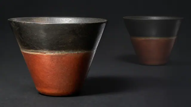
The Western Deffufa raised masses of mudbrick using techniques that required maintenance and planning. Kerma vessels, modelled by hand, achieved thin walls and red and black surfaces by controlling firing atmospheres.
Nuri developed steep-sided pyramids and chambers; Meroe combined stone, brick and metallurgy. Sharing forms with Egypt does not eliminate local technical decisions.
What they believed
The Western Deffufa may have served ceremonial and administrative functions, but its exact ritual is not written down. At Gebel Barkal, the cult of Amun linked landscape, Kushite royalty and pharaonic traditions.
The Kushites did not passively copy Egypt: they selected names, images and temples to legitimise power in a Nubian landscape. Meroe added its own deities and practices.
Who they interacted with
Nubia linked central Africa, the eastern and western deserts, Egypt and the Mediterranean. Gold, livestock, ivory, ebony and organic products circulated alongside people and techniques.
Kerma vessels found in Abydos may belong to Nubian travellers or residents. Their presence demonstrates contact, not a single direction or subordination.
Art, music and storytelling
Kerma pottery, jewellery and Kushite monuments show artistic traditions that changed over many centuries. Artisans worked with local resources and materials obtained through exchanges.
Preserved images and instruments help study music and ceremonies in specific contexts. They do not allow attributing the same melody or practice to all Nubian societies.
PEOPLE AND TESTIMONIES
Meet the people
The records distinguish historical figures, representations and reconstructions. They explain their context, the available sources and their connections with other people.
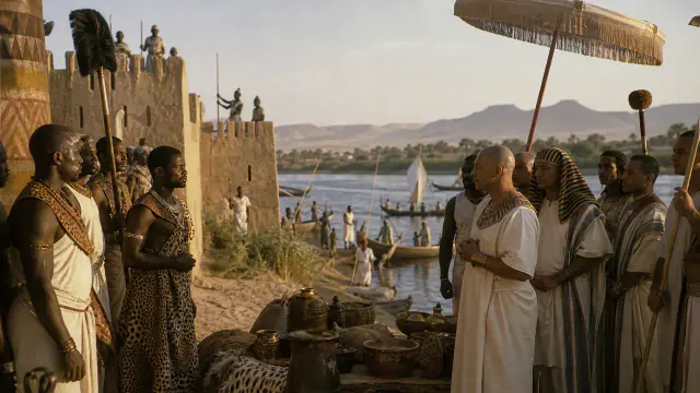
Disputed frontier
The Nubian frontier was a space of negotiation and war, not a fixed line.
Read the record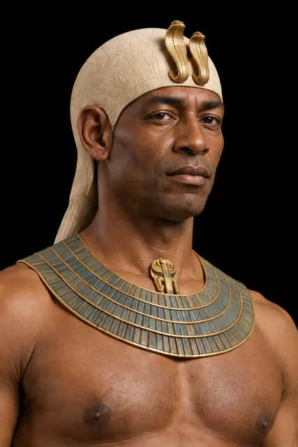
LOOK CLOSER
Objects and places to start with
A selection from the destination museum. Open each record to explore its documentation and images.
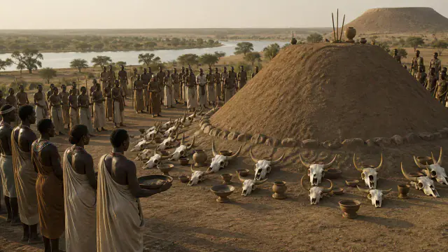
Livestock and mounds
Livestock skulls deposited alongside tombs show their economic and funerary importance.
Read the record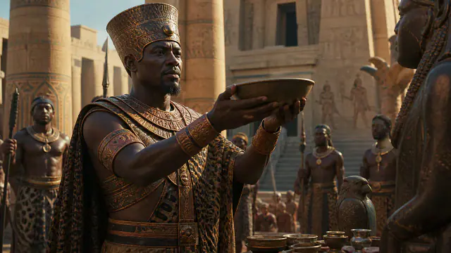
Kushite king
A small bronze figure reminds us that Nubia ruled Egypt, it was not merely ruled by it.
Read the record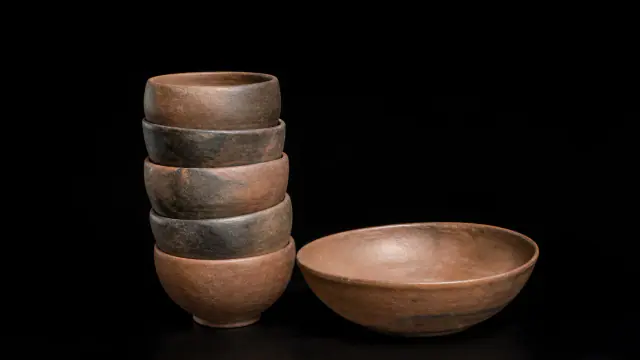
Burial at K IV
Five vessels and a bowl accompanied a person buried next to a large Kerma mound.
Read the recordWHAT REMAINS
Its legacy and ongoing research
The Nubian sequence shows a long-lasting, autonomous African history and challenges the idea that civilisation on the Nile ended in Egypt.
CHOOSE YOUR NEXT STOP
Inside this museum
Sources for this introduction
Each theme links to its documentation. The full bibliography also brings together sources for the chronology, the people and the connection between the museums.
View all sources and references →Evidence and interpretation
Level of evidence of connection: high. The door describes contact; it does not convert two different cultures into one nor does it presuppose automatic ethnic continuity.
Catalogue facts
- Contact period
- III millennium BCE–IV century CE
- Destination museum
- Nubia: Kerma and Kush
- Link Type
- contact
- Level of evidence
- high
- Destination region
- Africa
A closer look
About 1 min to read · 1 section. Further reading and sources · free access. Editorial review recorded: .
Egyptian specialists at the service of a Kushite king
The Taharqa sphinx EA1770 in the British Museum comes from the T temple of Kawa and bears the characteristic double uraeus of Kushite royalty. The museum's commentary relates its context to the construction of the temple, begun in the sixth year of the reign, by architects and workers arrived from Memphis. This case offers a concrete connection other than conquest or exchange of objects: circulation of specialists towards a project sponsored by a king of Kush. The use of Egyptian forms does not erase the initiative of the promoter nor does it turn the monument into a simple extension of Egypt.
- Museum · British Museum · Sphinx of Taharqo, EA1770Access recorded: .
Location and territory
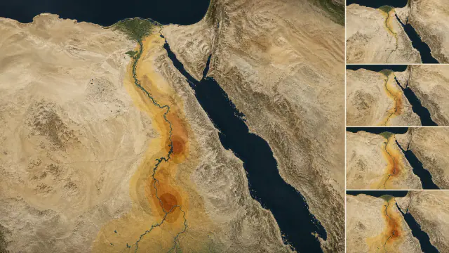
REGIONAL AREA
Upper Nile Corridor; Kerma, Napata and Meroe were not a single StateUpper Nile Corridor; Kerma, Napata and Meroe were not a single State. The footprint marks the indicative center of the area, not a border or an exact point.Cultural connections
Sources and references
- The British Museum — AEGYPTO CAPTA denarius, 1866,1201.4189
- British Museum — Sudan, Egypt and Nubia
- Harvard White-Levy Program — Amulets of the Kerma Culture
- British Museum, EA1770, inscribed sphinx of Taharqo, Kawa
- UNESCO — Gebel Barkal and the Sites of the Napatan Region
- Ministry of Tourism and Antiquities of Egypt · historical periods
- The Met · Egypt, 1000 BCE–1 CE
- Metropolitan Museum — Sudan, 2000–1000 B.C.
- Metropolitan Museum — Classic Kerma Beaker
- British Museum — Kerma beaker from Tumulus K IV
- UNESCO — Archaeological Sites of the Island of Meroe
- Metropolitan Museum — Statue of a kneeling Kushite king
- Ashmolean Museum, sanctuary of Taharqa, c. 680 BCE, official record
- Ashmolean Museum, Egypt and Sudan gallery, AN1936.661
- British Museum, EA1779, figure of Taharqo protected by Amun the Ram
YOUR NEXT VISIT
Explore Nubia
The same collection, two ways to explore. Choose the experience that suits you.
Did you enjoy this exhibit?
Your opinion helps us improve the museum. You can change it whenever you like.
Loading your rating…