
 English
 Español
 Français
 Italiano
 Deutsch
 Русский
 Português
 Polski
 Română
 Svenska
 Norsk bokmål
 Suomi
 Türkçe
 العربية
 简体中文
 한국어
 हिन्दी
 Ελληνικά
ARCHITECTURE AND LANDSCAPE · 01
Els Vilars: a Fortress Before the Classical Iberians
The fortress of Els Vilars had towers, ditches and a stone field that made approach difficult.
Museum documentation · free public access, no account required.
Reconstruction · Declared visual hypothesis
Interpretative reconstruction generated by AI of Vilars I, towards 600 BCE, guided by the published phase plan by the team of the University of Lleida. Rectangular houses, oval enclosure and stone field respond to archaeological evidence; elevations, roofing, compartment details and landscape are hypothetical. It does not reproduce an exact metric survey. Landscape reference: Chixoy, CC BY-SA 4.0; consulted plan: F. Riart, Els Vilars catalogue, fig. 5.
OpenAI ImageGen; accredited photographic references separately · CC BY-SA 4.0
History and context
Ditches, walls, towers and a stone field protected a settlement from the Early Iron Age; its long sequence obliges us to recount antecedents and transformations.
Evidence and interpretation
Synthesis based on National Archaeological Museum · Auletrix; Museum of Prehistory of Valencia · Iberian world; Museum of Jaén · El Pajarillo. The comparison serves to formulate questions, not to fill gaps in the record with certainties.
Catalogue facts
- Civilisation or trajectory
- Iberian peoples of the peninsula
- Scope
- Building and Power
- Main area
- Mediterranean façade and south of the Iberian peninsula, with communities, languages and trajectories different.
A closer look
About 1 min to read · 1 section. Further reading and sources · free access. Editorial review recorded: .
The Wall Ended Up Containing Centuries of Reconstructions
The new houses of Els Vilars were repeatedly raised over remains of earlier phases. The accumulation within the enclosure produced an artificial mound or tell. Mechanised agricultural work of the 20th century razed part of the upper levels, but a margin between properties conserved a section that still allows viewing the superposition. The case explains why an archaeological plan does not necessarily gather buildings that are contemporary. It also shows that modern losses condition our image of the last fortress as much as ancient abandonment and erosion processes.
Reference images and provenance
 View full-size photograph ⛶
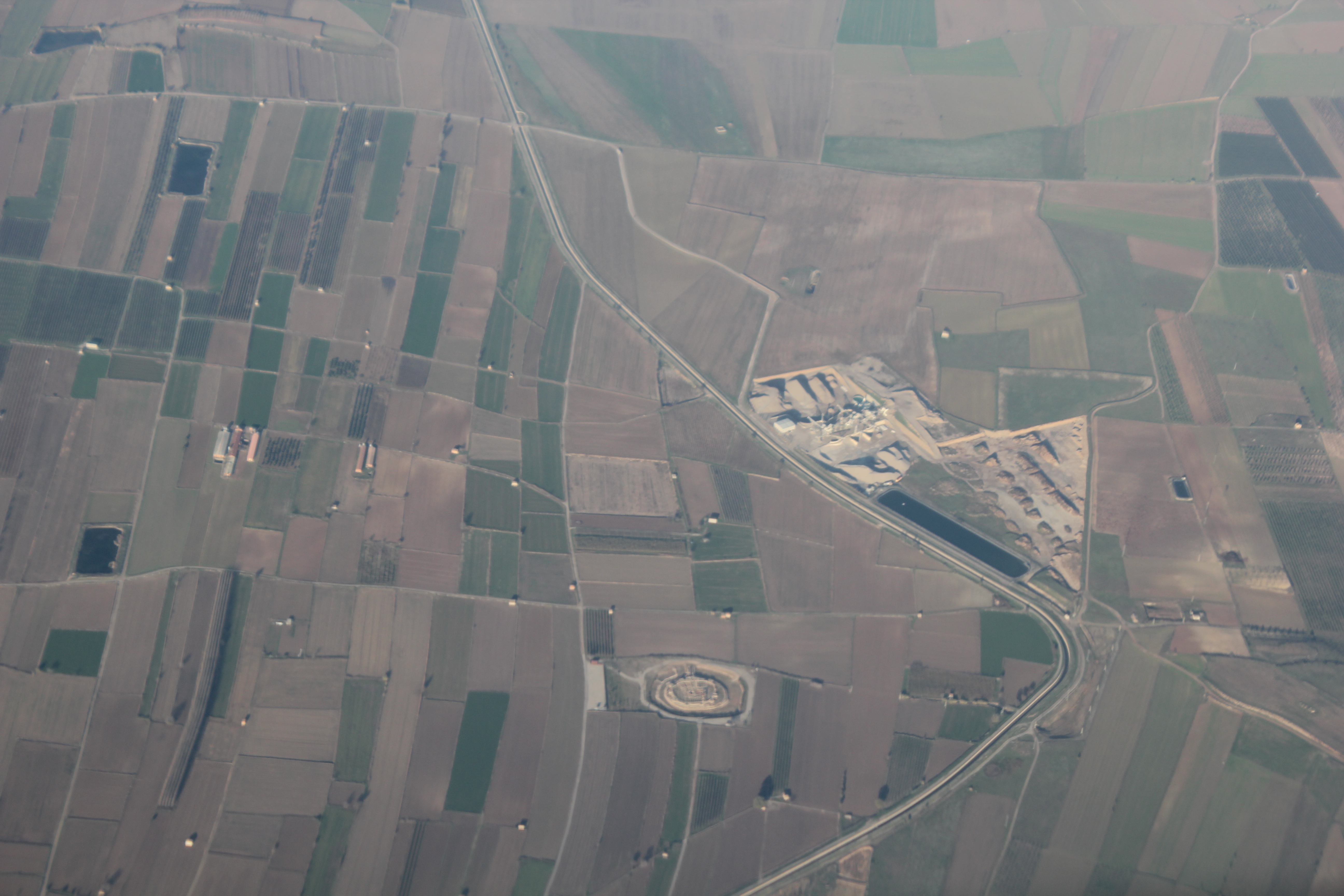
Aerial photograph by Chixoy of the current landscape of Arbeca. Els Vilars appears small, in the lower central part: the framing serves to situate the fortress in the plain, not to interpret the detail of its dwellings. Plots and paths are modern. Only format conversion and web reduction; no reconstruction by AI.
Contextual image · Contextual correspondence
Chixoy

Location and territory
REGIONAL AREA
Mediterranean façade and peninsular south; not all Iberia was IberianMediterranean fringe and southern peninsula; not all Iberia was Iberian. The footprint indicates the orientative centre of the area, not a boundary nor an exact point.Sources and references
Did you enjoy this exhibit?
Your opinion helps us improve the museum. You can change it whenever you like.
Loading your rating…