
 English
 Español
 Français
 Italiano
 Deutsch
 Русский
 Português
 Polski
 Română
 Svenska
 Norsk bokmål
 Suomi
 Türkçe
 العربية
 简体中文
 한국어
 हिन्दी
 Ελληνικά
FORTRESS · WATER, HORSES AND POWER
Els Vilars
A small community behind massive defences
Walls, towers, a moat and embedded stones protected this small settlement.
Museum documentation · free public access, no account required.
Reconstruction · Declared visual hypothesis
AI-generated interpretive reconstruction of Els Vilars towards the 4th century BCE. The floodable moat, masonry and adobe are based on the archaeological project of the University of Lleida. Heights, finishes, visible houses, roofs, original surfaces and landscape are hypotheses; it is not a photograph of the original nor a metric restitution of all walls. Compositional reference: Jaumeboldu, CC BY-SA 4.0.
OpenAI ImageGen; accredited photographic references separately · CC BY-SA 4.0
History and context
The fortress was founded around 775 BCE and abandoned around 300 BCE. A wall with towers, moat and field of embedded stones created an exceptional barrier in a plain where control of water and alluvial lands was as important as defence.
Its founders belonged to the urn fields horizon; later generations experienced Iberianisation and ended up within the Ilergete sphere. The site allows narrating cultural transformation without inventing an immutable ethnic genealogy.
The IV century BCE well-cistern, the archaeobotanical diet and deposits related to horses return everyday work to an architecture that could seem only military.
Evidence and interpretation
Documented fact: chronology, phases, defences, cistern and environmental data come from the archaeological project of the University of Lleida. Interpretation and caution: the reason for such large defences, the equestrian rites and the abandonment remain open.
Catalogue facts
- Narrative date
- ≈775–300 BCE
- Location
- Arbeca (Lleida)
- Material
- Adobe, stone, wood, water and landscape
- Context
- Fortress of the Early Iron Age and Iberian
- Classification
- Iberian collection or explicit interpretive resource
- Visual reference
- Aerial view and 3D reconstruction of the Vilars-UdL project
A closer look
About 1 min to read · 1 section. Further reading and sources · free access. Editorial review recorded: .
Water was part of the defence, not only of supply
The research of the University of Lleida identifies floodable moats and structures for managing its water. It also revises the denomination of the central element: it is interpreted as a well, although for a time it was described as a cistern. The change matters because it distinguishes capturing water from storing it. The choice of location combined fertile land, communications and hydraulic control. The current landscape, deeply transformed by irrigation and levelling since the 19th century, can hide that logic. To understand the fortress, one must also reconstruct the ancient water circulation around its walls.
- Research · University of Lleida · Els Vilars: surroundings and waterAccess recorded: .
Reference images and provenance
 View full-size photograph ⛶
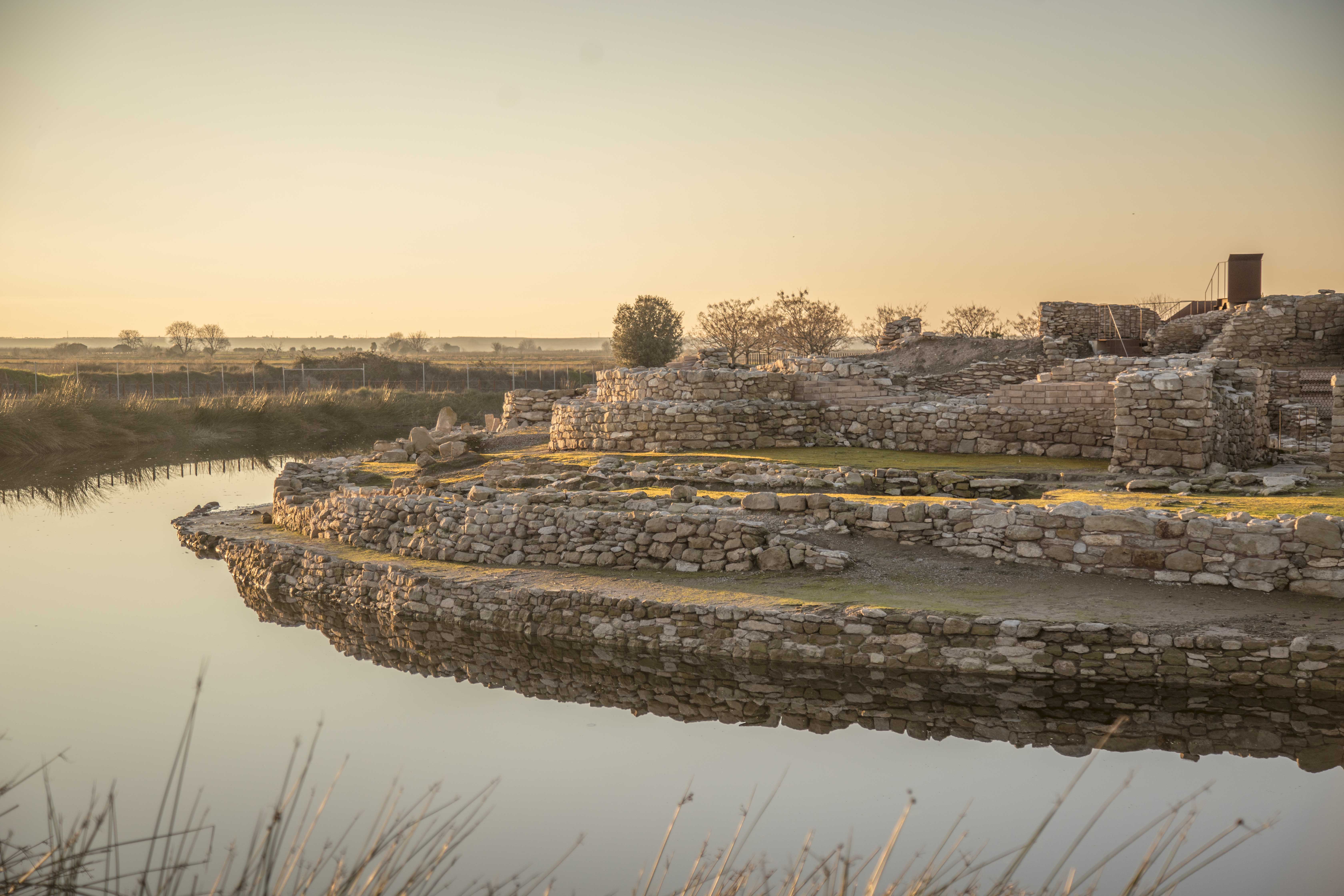
Photograph by Jaumeboldu of the current Els Vilars site. Excavated ruins, consolidations and modern visitor elements are visible; it does not represent the full aspect of an ancient phase. It replaces the illustration with circular huts and undocumented wooden defences for this view. Only format conversion and web reduction; no reconstruction by AI.
Documentary original · Exact correspondence
Jaumeboldu

Sources and references
Did you enjoy this exhibit?
Your opinion helps us improve the museum. You can change it whenever you like.
Loading your rating…